


 Leeds
Leeds
 Doncaster
 Sheffield
 Bradford
 Hull
Hull
 Halifax
 Sunderland
 Newcastle
 Middlesborough
 Yorkshire Moors
 Teesside
 Cumbria
 Harrogate
 Teesdale
 York
York
 Yorkshire Dales
 Northumberland
 Goole
Goole
 Carlisle
 Keswick
 Kendal
 Barrow-in-Furness
 Lancaster
 Blackpool
 Morecambe
 Southport
 Liverpool
 Wigan
Wigan
 Manchester
 Blackburn
 Burnley
 Forest of Bowland
 Oldham
 Chester
 Stockport
 Peak District
 Skipton
 Crewe
Crewe
 Rotherham
 Stoke
Stoke
 Driffield

A nationwide surveying and engineering company operating in both the public and private sectors.

Read about our Surveying Services, which include Topographical Services, Utility Mapping and Monitoring Campaigns.

We have created some answers to a series of questions which explains a little more about our services.
Head Office
North West Office
Glasgow Office
Bedford Office
Bedford Office
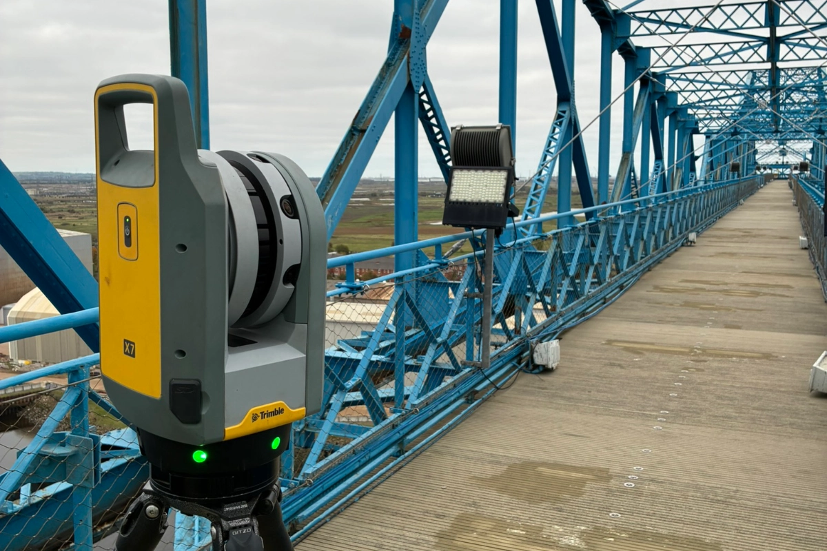
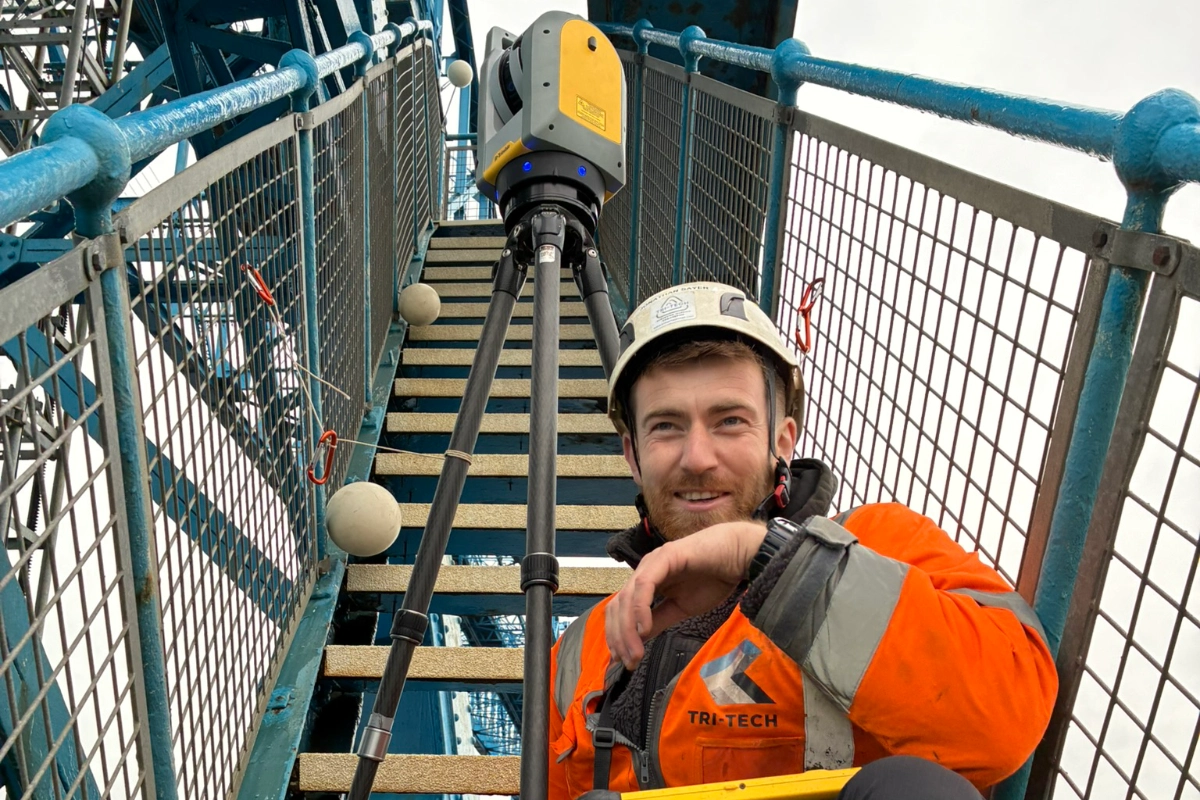
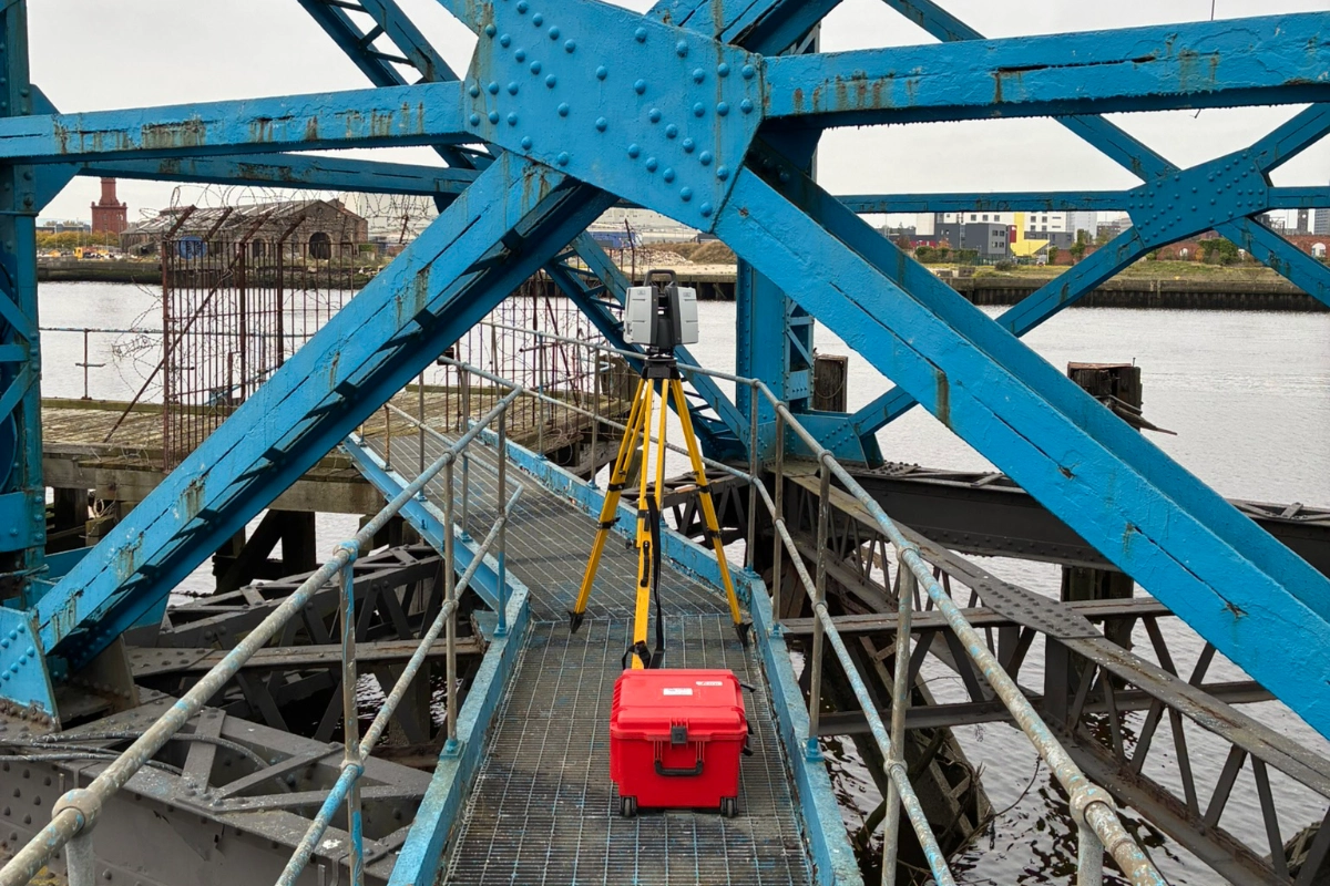
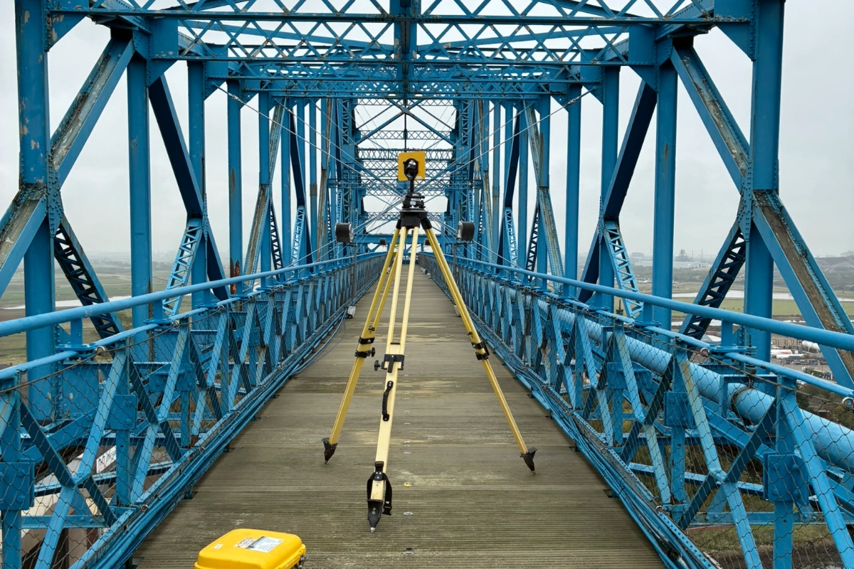
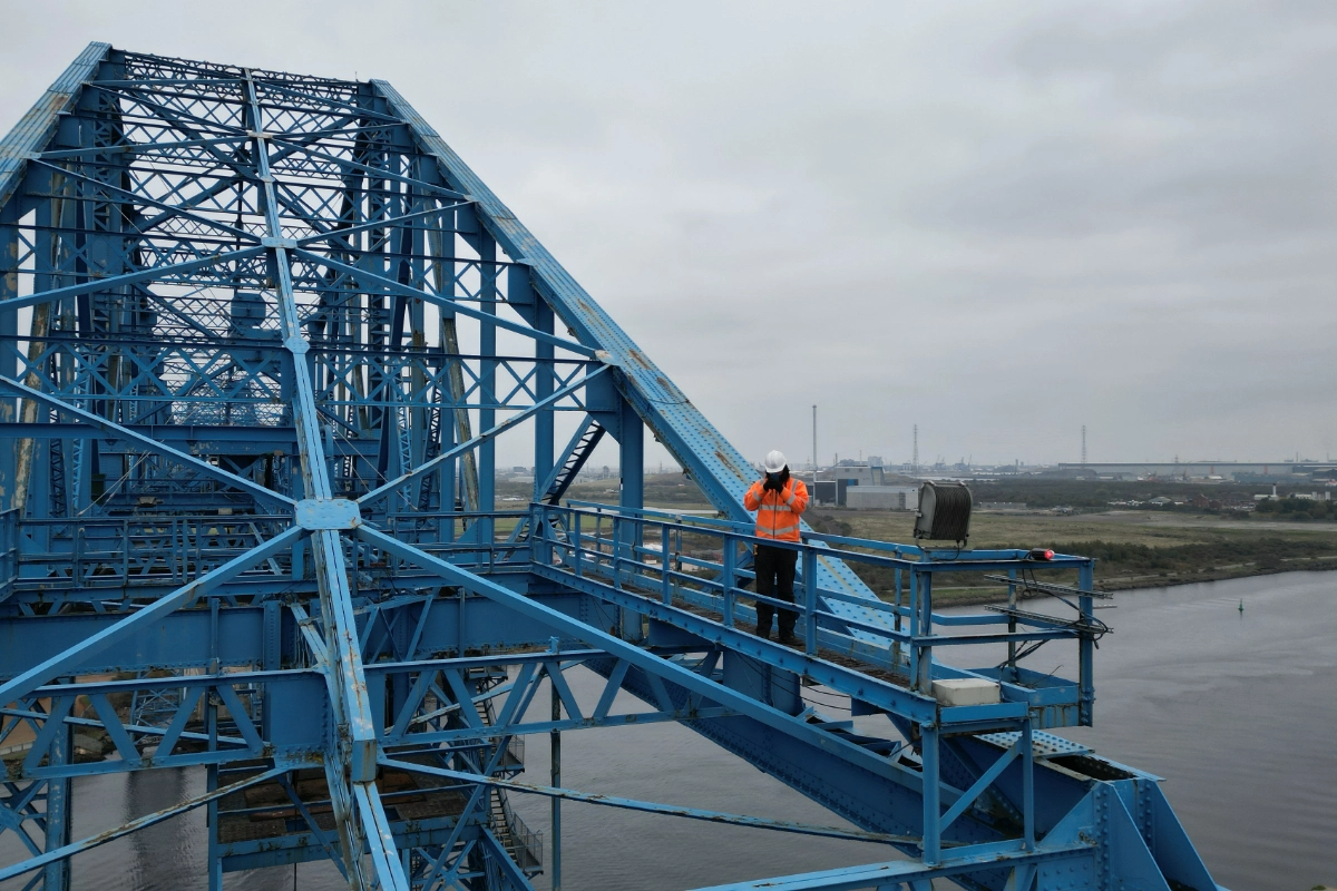
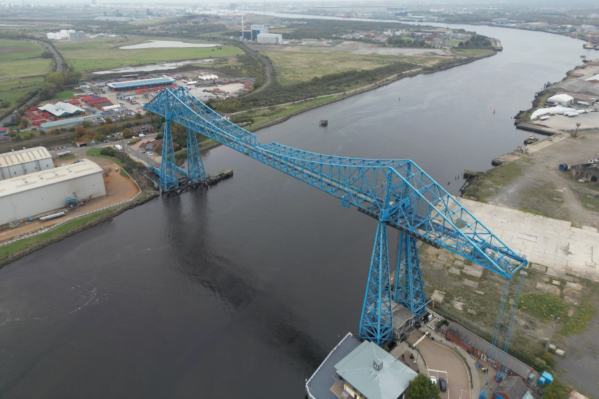
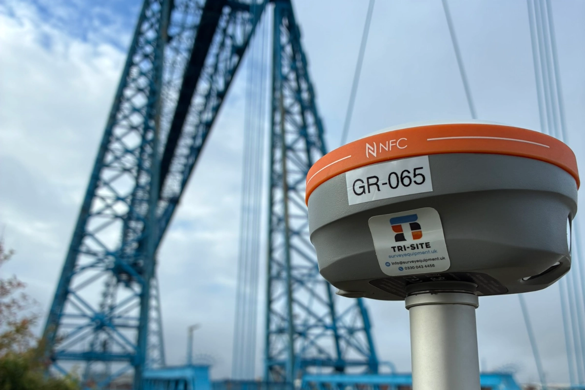
Tri-Tech undertook a major multidiscipline surveying project on the Tees Transporter Bridge, one of the North East’s most recognisable pieces of engineering heritage. For over a century since it first opened, the bridge has played an important role in supporting the community, workers, and visitors crossing the River Tees. As the structure approaches a significant programme of restoration works, Tri-Tech worked alongside AtkinsRéalis engineers & Middlesbrough Council to provide high-accuracy digital data to understand its current condition and plan essential improvements with confidence.
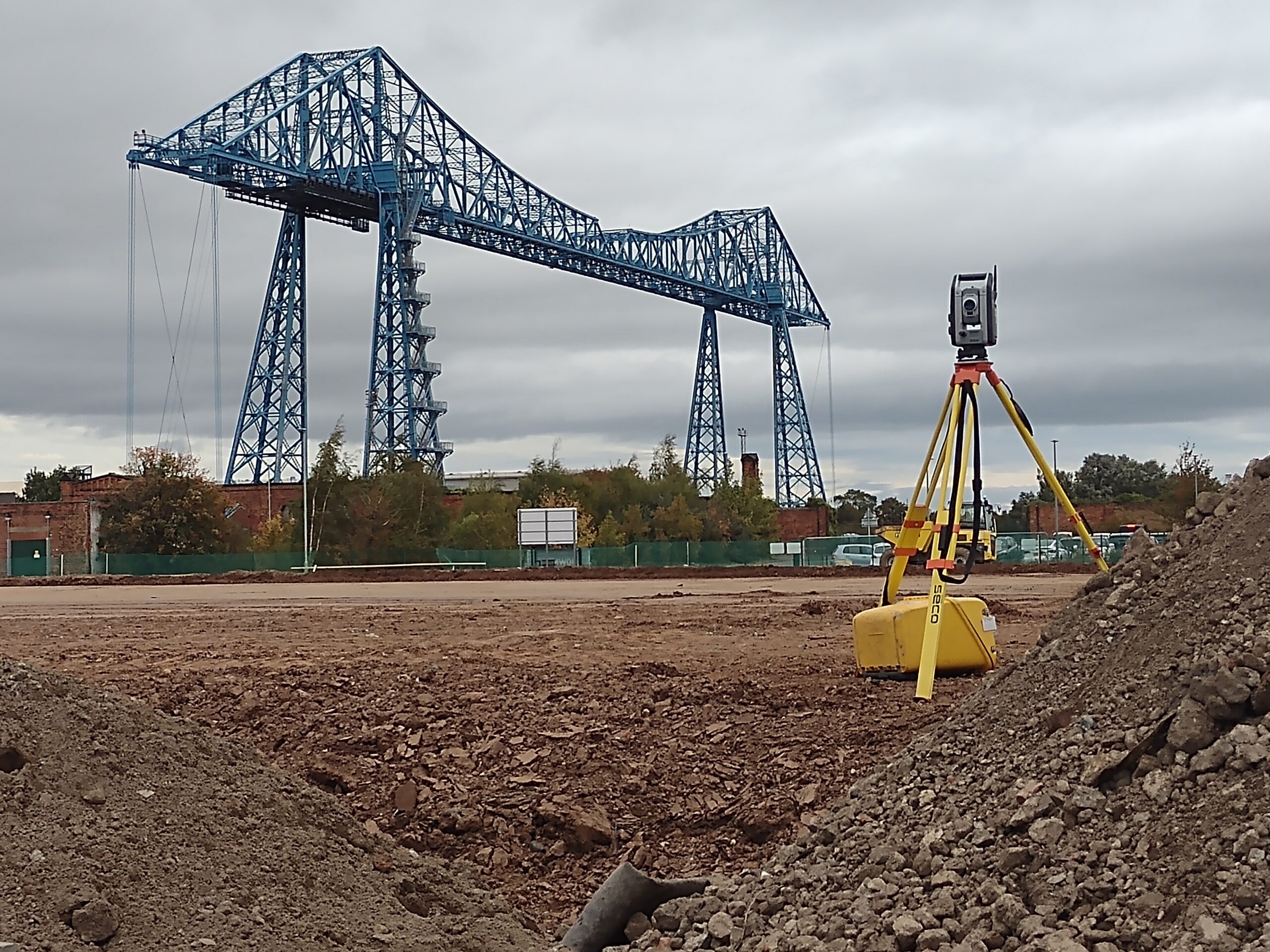
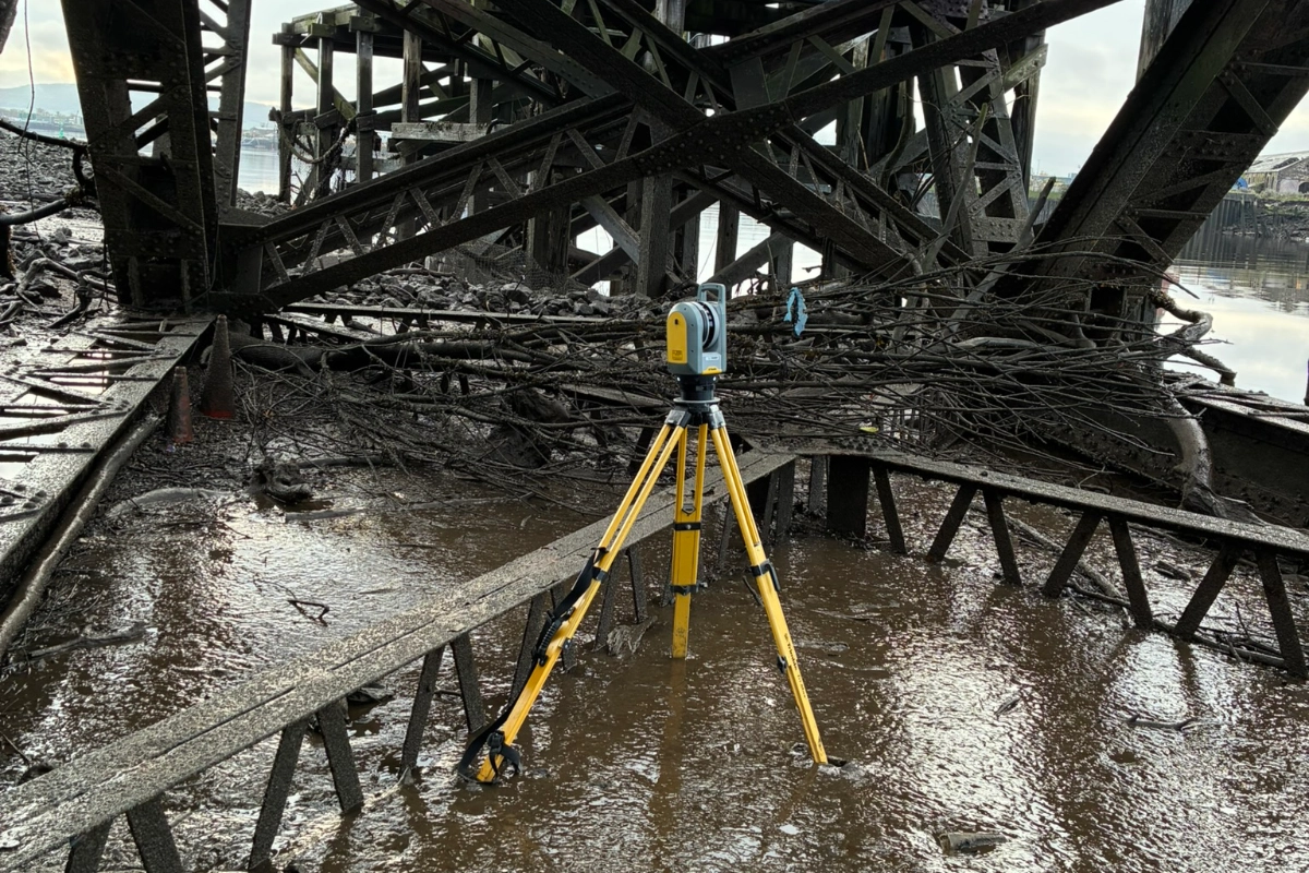
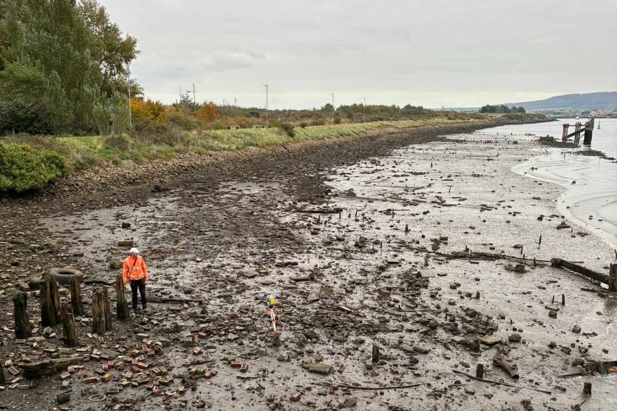
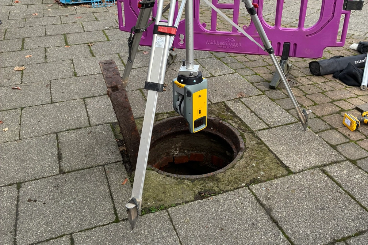
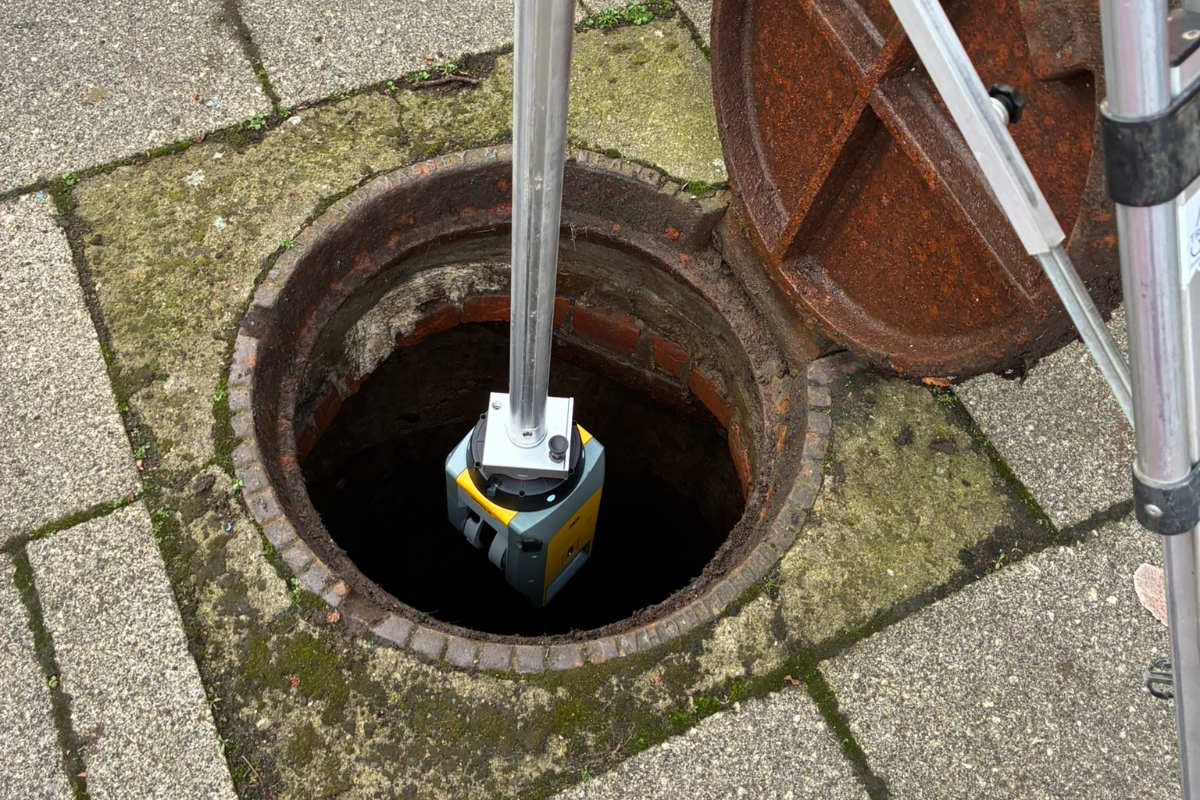
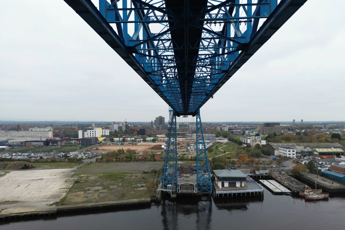
Tri-Tech were commissioned to deliver a comprehensive point cloud survey, full topographical mapping, UAV aerial LiDAR and bathymetric survey capturing the bridge including the land on both sides of the river in order to create a complete, digital dataset suitable for structural analysis, design coordination and future modelling.
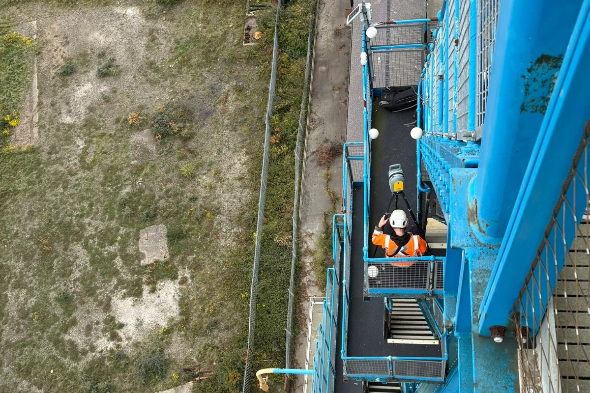
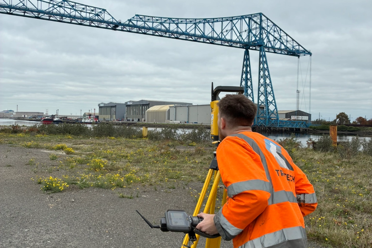
The brief required a complete and precise record of the bridges as built condition including a detailed record of the structural framework that makes up the bridge as well as the surrounding land on both sides of the river. Engineers needed data suitable for structural analysis, Revit and BIM modelling, future upgrade planning, constructability assessments and understanding of the topography and infrastructure around the bridge. Every detail captured allowed the team to develop a deeper understanding of the bridge, how it’s made up and how it has changed over time. This data will then be used to develop future refurbishment options and plan for long-term operation.
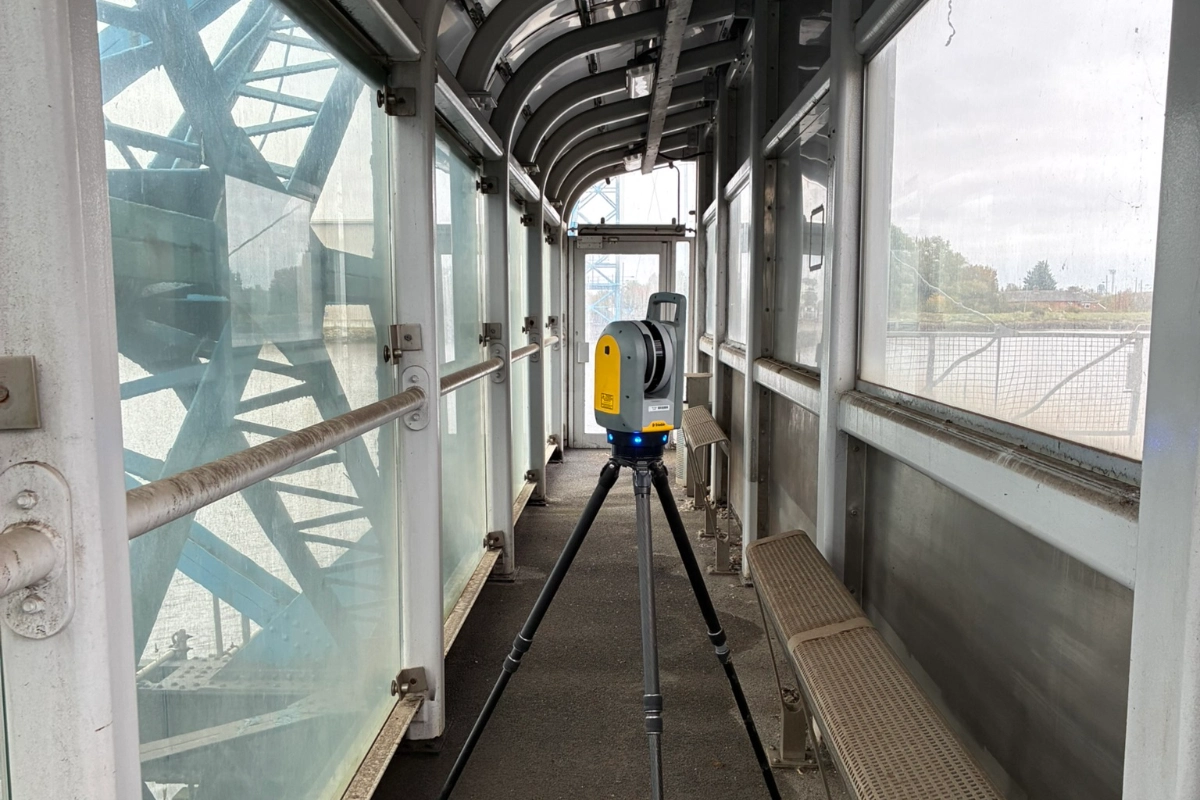
To meet this complex scope, Tri-Tech combined multiple surveying technologies into a single coordinated workflow.
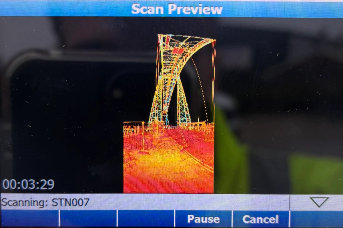
High-density, long-range laser scans captured the full geometry of the bridge steelwork, walkways, towers, and connection points. This created a millimetre-accurate point cloud for structural engineers and BIM teams.
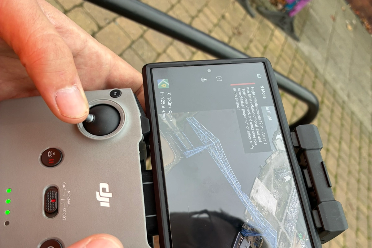
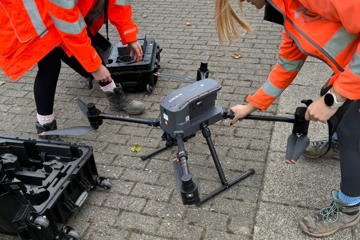
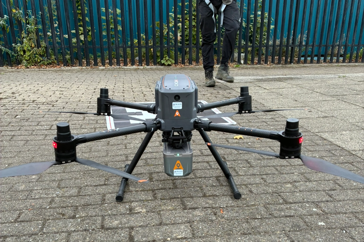
Using a drone fitted with a LiDAR sensor, we surveyed hard-to-access components and large spans efficiently, while also capturing the topography of the land on both sides of the Tees. UAV LiDAR ensured excellent penetration through gaps and complex steelwork.
We mapped ground levels, boundary features, road infrastructure, access routes and terrain changes – providing engineers with a complete understanding of the site context.
This blended approach ensured complete coverage of a structure that cannot be safely or practically surveyed using a single method. By integrating terrestrial scanning, UAV LiDAR, bathymetric survey and detailed topo mapping, Tri-Tech provided a unified dataset that reflected both the condition of the bridge and the environmental context around it.
The surveying work offered project engineers a reliable and verifiable foundation for all future design and upgrade activities. With precise structural data and accurate ground modelling, engineers were able to make well-informed decisions on clearance, access, staging and construction planning.