Professional Aerial & Drone Surveying Services Across the UK
Based in Yorkshire, Operating Nationwide
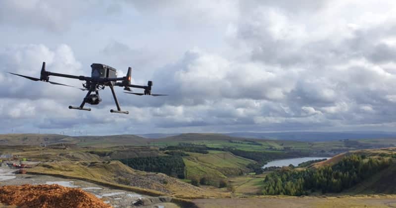
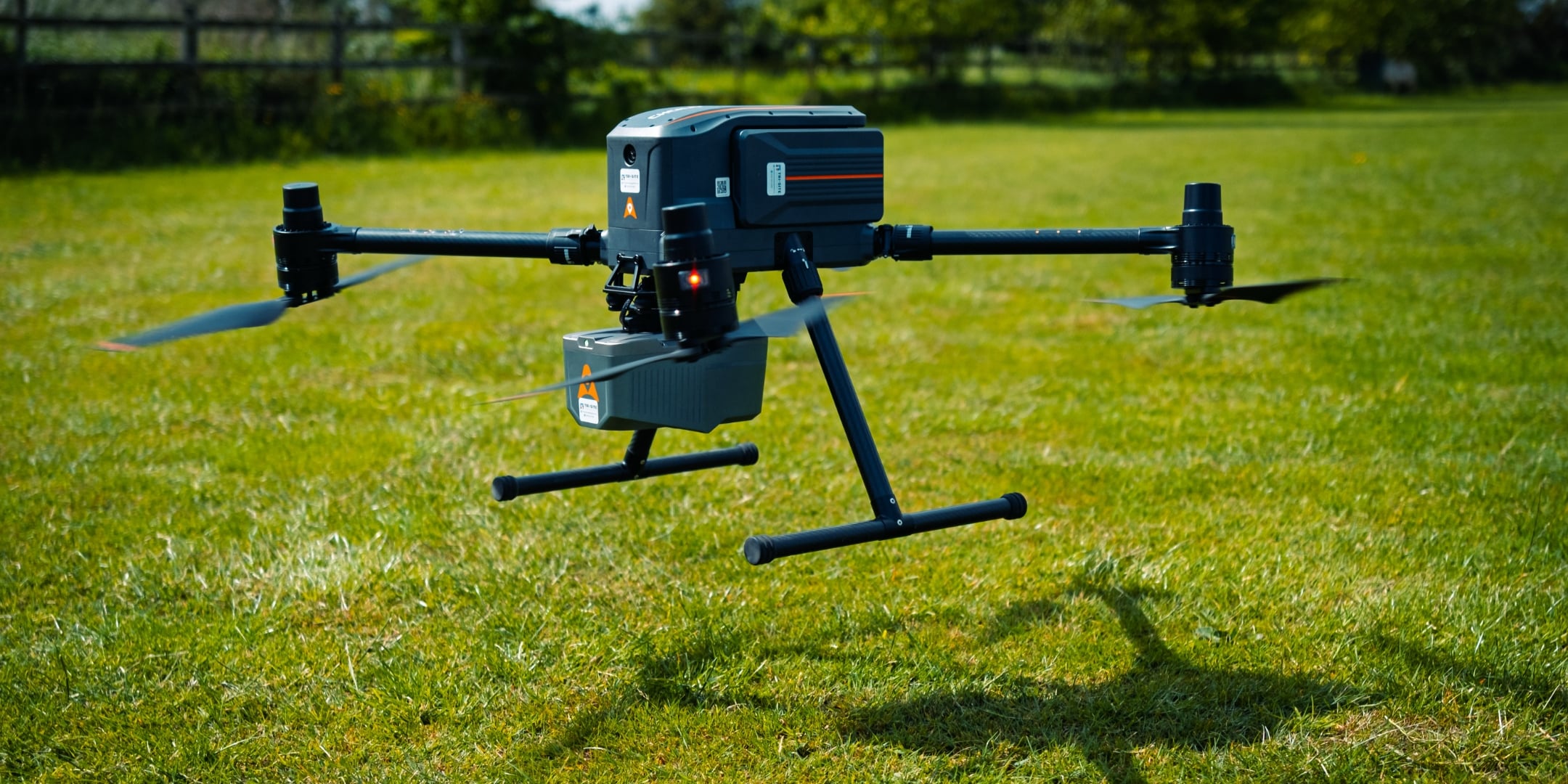
Since the beginning of 2017 Tri-Tech have been operating UAVs for drone surveys under CAA (Civil Aviation Authority) rules and while also holding the relevant insurance to carry out mapping, site progress and inspection works.
Our first pilot was trained in 2016 and we now have a number of fully qualified pilots who all fly inside the rules at all times. We put in place procedures and measures such as regular training and an operator’s manual to ensure this happens.
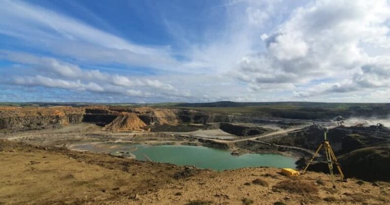
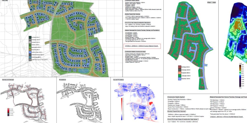
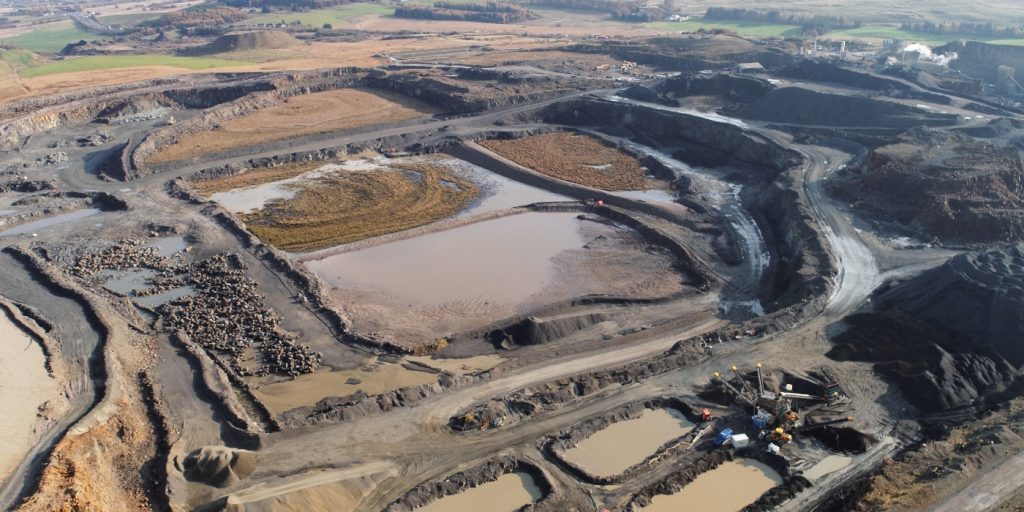
Large areas of ground can be covered, capturing the most unbelievable detail which would just be unable to be recorded with traditional methods. Our clients have really seen the benefit of what UAV surveys bring to the table. The money they save and the data they receive as a deliverable have left them in no doubt that Tri-Tech are one of the premier providers of this service nationwide.
Aerial and drone surveys are transforming how modern surveying data is collected, analysed, and delivered. By integrating UAV (Unmanned Aerial Vehicle) technology with advanced sensors such as LiDAR and high-resolution photogrammetry, we capture fast, accurate, and highly detailed spatial data for a wide range of projects and industries. At Tri-Tech, we offer expert drone surveying services throughout Lancashire and the wider UK – ideal for topographical mapping, construction, infrastructure planning, environmental monitoring, and more.
What Is Aerial & Drone Surveying?
Aerial and drone surveying uses unmanned aerial vehicles (UAVs) equipped with specialised sensors to capture data from above the ground. These aircraft collect high-accuracy measurements which can be processed into:
3D point clouds
Digital elevation and terrain models
Orthomosaic maps
Volumetric analyses
GIS and CAD deliverables
This aerial approach provides a comprehensive view of terrain, structures and landscapes - often faster, safer, and more cost-effective than traditional ground methods.
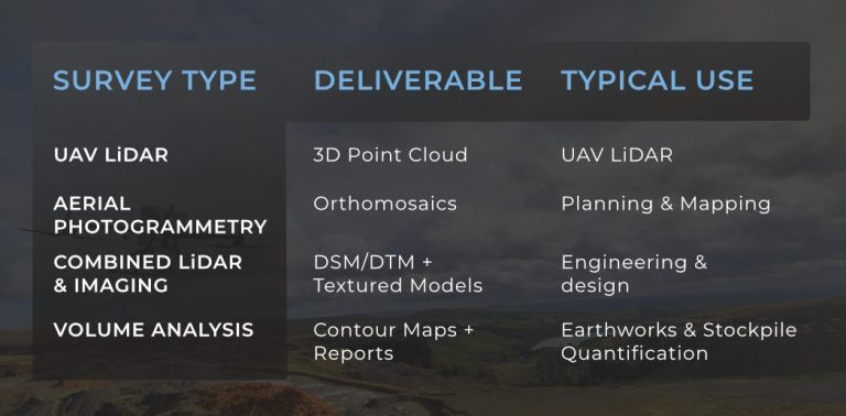
Types of Aerial & Drone Surveying We Provide
Tri-Tech offers a range of aerial survey solutions to match your project needs:
UAV LiDAR Surveying
LiDAR (Light Detection and Ranging) uses laser pulses to measure distances and build highly precise 3D models of the ground and surface features.
IDeal for:
Large sites with vegetation cover
Terrain modelling & contour mapping
Infrastructure development & alignment
Volumetric and stockpile measurement
benefits are
Penetrates vegetation for ground surface modelling
Generates accurate point clouds with centimetre-level precision
Faster data capture than traditional methods
Aerial Photogrammetry
Photogrammetry uses high-resolution cameras mounted on drones to capture overlapping images which are processed into detailed maps.
IDeal for:
Orthophoto maps
Surface modelling
Visual site documentation
Planning and volume measurement
benefits are
Cost-effective for medium-range surveys
Excellent visual detail and texture mapping
Outputs integrate with GIS and CAD systems
Combined LiDAR & Photogrammetry
Photogrammetry uses high-resolution cameras mounted on drones to capture overlapping images which are processed into detailed maps.
Why Choose UAV Aerial Surveys?
Using drones for survey data collection delivers major advantages over conventional techniques:
Speed & Efficiency
Drones can cover large areas rapidly and return data for processing within a short time frame - often reducing weeks of fieldwork to a single flight.
Accuracy & Detail
Advanced sensors like LiDAR and RTK-enabled cameras deliver centimetre-level accuracy, producing reliable outputs for critical decision-making.
Safety & Access
UAVs capture data from above, reducing the need for surveyors in hazardous or hard-to-reach areas - improving safety and lowering risk.
Cost-Effective
Compared to manned aerial surveys or extensive ground crews, drone surveys are more cost-efficient while providing high-quality deliverables.
Applications of Aerial & Drone Surveys
Drone and aerial surveys benefit a wide range of project types:
Topographical surveys & terrain mapping
Infrastructure planning & corridor mapping
Construction site monitoring
Environmental assessment & vegetation analysis
Stockpile & volumetric calculation
Flood risk & drainage assessment
Agricultural & forestry surveys
Heritage and archaeological site mapping
Deliverables & Output Formats
We provide outputs that integrate seamlessly into your workflow:
LiDAR derived point clouds (LAS, E57)
Orthomosaic and DSM/DTM maps
3D models and textured meshes
2D CAD drawings (DWG / DXF)
GIS-ready datasets
Volume and contour reports
All deliverables are georeferenced, clearly structured and ready for use in design, analysis, and decision-making.
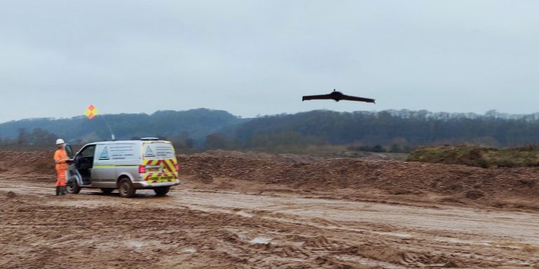
Drone surveying and aerial mapping are technologies that use unmanned aerial vehicles (UAVs), commonly known as drones, to collect data for surveying and mapping purposes.
Tri-Tech work for a variety of different clients on different projects, and we pride ourselves on delivering accurate, efficient, cost effective surveys ensuring our clients receive the best possible product.
Using the latest equipment, we can provide the location of underground services in either 2D or 3D. We use state of the art Ground Penetrating Radar and Electromagnetic Location to assist your project when service avoidance may be a potential issue on site.
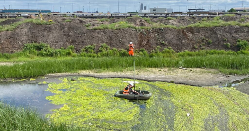
Is there any movement? That is the question that is asked before and during any monitoring scheme. That is the reason we undertake monitoring, to check for movement.
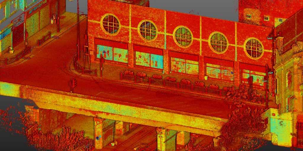
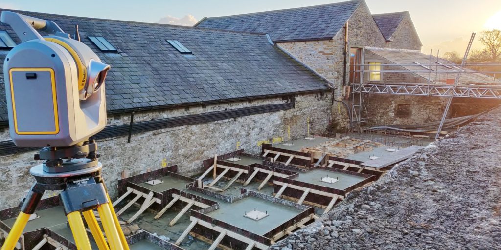
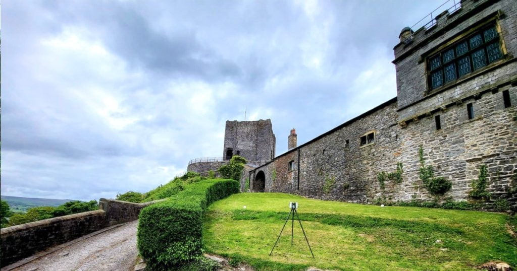
For mass collection of accurate survey data then nothing beats scanning. Using 3D laser Scanners the surveyors can capture millions of points per second with the creation of a PointCloud.
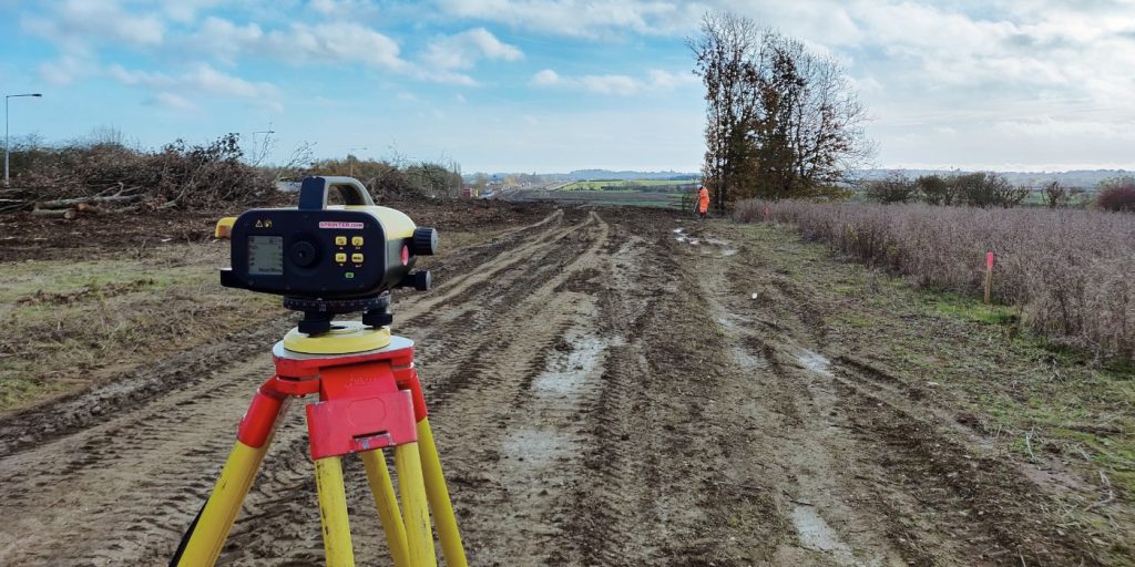
Bread and butter work for us! Having a strong relationship with many civil engineering companies we have a very strong team of Site Engineers and Engineering Surveyors working for us.
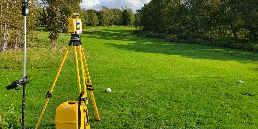
At Tri-Tech we have vast experience in this field. Be it a large highway scheme or a private property we can advise on what accuracies are required from your control network depending on what work you are carrying out and the tolerances you are carrying this work out to.
Large areas of ground can be covered capturing the most unbelievable detail which would just be unable to be recorded with traditional methods. Our clients have really seen the benefit of what UAV surveys bring to the table.
Tri-Tech work for a variety of different clients on different projects, and we pride ourselves on delivering accurate, efficient, cost effective surveys ensuring our clients receive the best possible product.
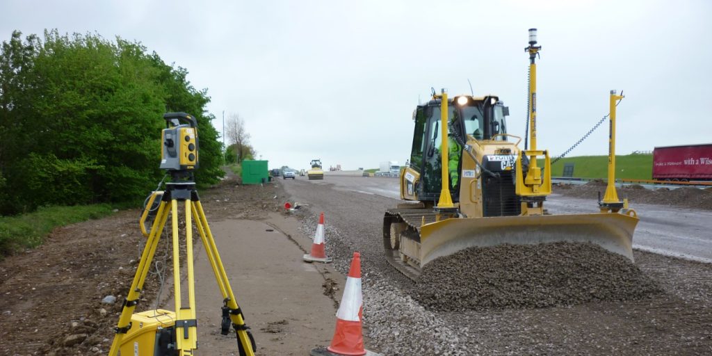
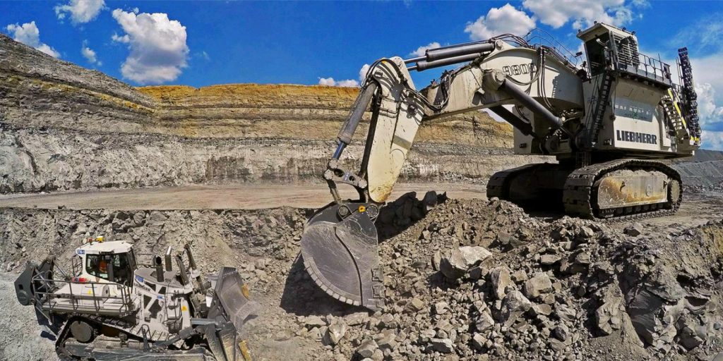
Machine control systems have been around for years now and Tri-tech have been utilising these systems from the very start. We realised the benefits of these systems early on when working with earthworks contractors.
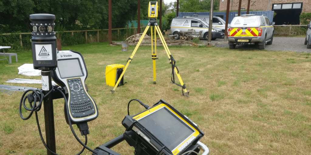
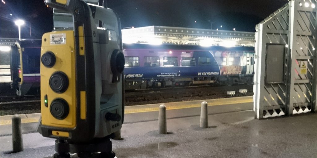
Being a leader in the Surveying and Engineering sector we have a fleet of modern survey equipment at our disposal which is second to none. We carry the latest GNSS Base Stations, GNSS Rovers, Robotic Total Stations, Laser Scanners, Digital Levels, and Dual Grade Lasers.
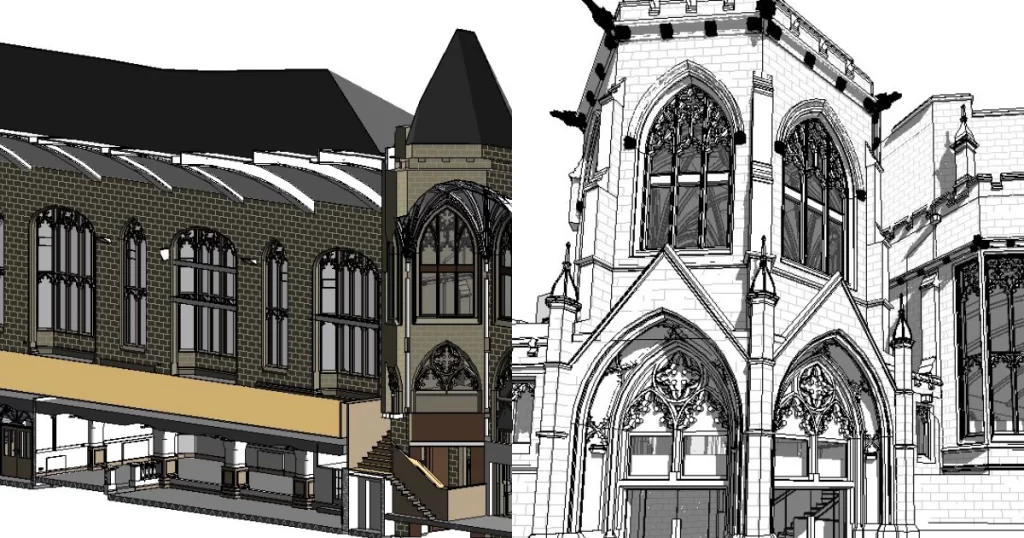
BIM (Building Information Modelling) model creation in surveying refers to the process of using specialised software to create a 3D digital model of a building or infrastructure project that includes information about the project’s design, construction, and maintenance.
Virtual Tour 3D is an immersive experience which instantly transports your clients to your business, and guides them through your space, creating a seamless and captivating experience.


 Leeds
Leeds Doncaster
 Sheffield
 Bradford
 Hull
Hull Halifax
 Sunderland
 Newcastle
 Middlesborough
 Yorkshire Moors
 Teesside
 Cumbria
 Harrogate
 Teesdale
 York
York Yorkshire Dales
 Northumberland
 Goole
Goole Carlisle
 Keswick
 Kendal
 Barrow-in-Furness
 Lancaster
 Blackpool
 Morecambe
 Southport
 Liverpool
 Wigan
Wigan Manchester
 Blackburn
 Burnley
 Forest of Bowland
 Oldham
 Chester
 Stockport
 Peak District
 Skipton
 Crewe
Crewe Rotherham
 Stoke
Stoke Driffield