


 Leeds
Leeds Doncaster
 Sheffield
 Bradford
 Hull
Hull Halifax
 Sunderland
 Newcastle
 Middlesborough
 Yorkshire Moors
 Teesside
 Cumbria
 Harrogate
 Teesdale
 York
York Yorkshire Dales
 Northumberland
 Goole
Goole Carlisle
 Keswick
 Kendal
 Barrow-in-Furness
 Lancaster
 Blackpool
 Morecambe
 Southport
 Liverpool
 Wigan
Wigan Manchester
 Blackburn
 Burnley
 Forest of Bowland
 Oldham
 Chester
 Stockport
 Peak District
 Skipton
 Crewe
Crewe Rotherham
 Stoke
Stoke Driffield


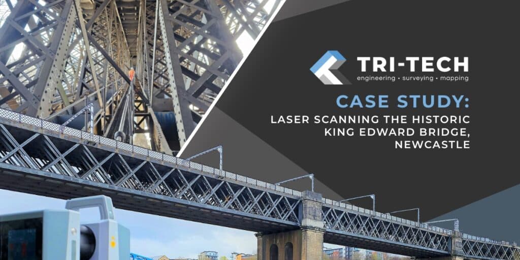
Case Study: Laser Scanning the Historic King Edward Bridge, Newcastle
project overview:
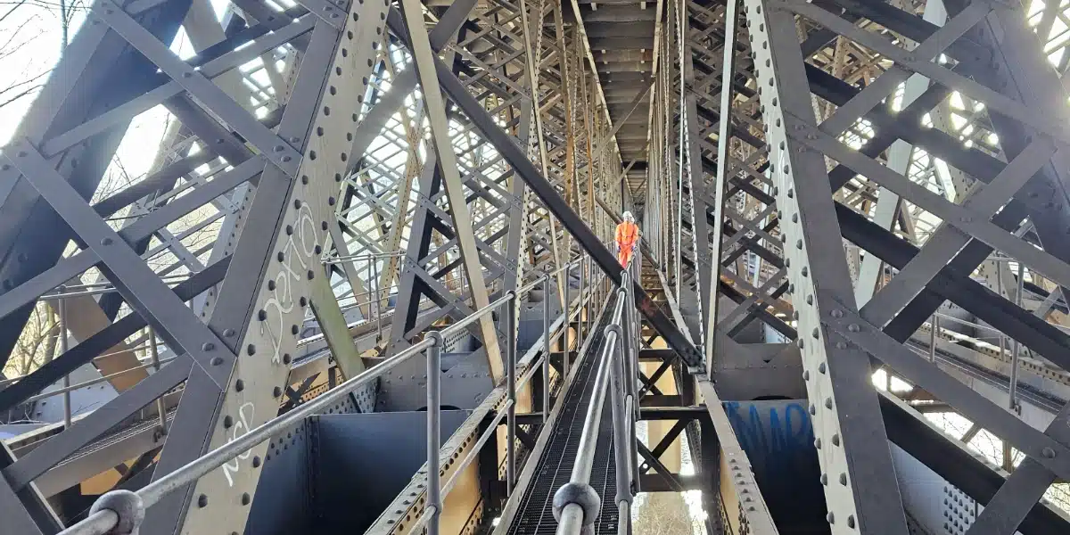
Spanning the River Tyne between Newcastle upon Tyne and Gateshead, the Kind Edward VII Bridge has stood since 1906 as a vital artery in the UK’s rail network. More than a century on, the Grade II listed structure continues to play an essential role in passenger and freight transport, making accurate survey data critical for its upkeep and future planning.
Tri-Tech were commissioned to deliver a comprehensive laser scanning survey of the bridge, capturing both its intricate architectural features and the operational rail infrastructure.
OUR APPROACH:
To capture the full complexity of the structure, our team combined careful planning and expertise with advanced technology:
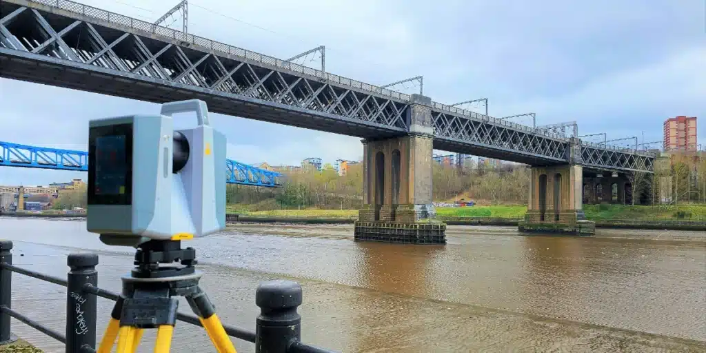
- A control network was installed on both sides of the bridge and at key points across its span, ensuring accuracy and alignment across all datasets.
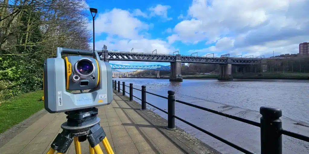
- Using the Trimble X12 laser scanner, we surveyed the bridge’s walkways, arches and topside rail tracks in high detail.
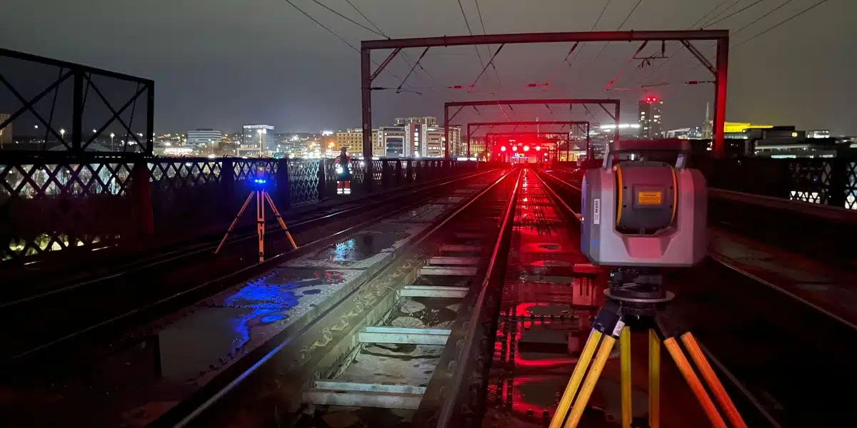
- Work was carried out during the day to map the surrounding environment, and during night shifts on the live railway above, ensuring minimal disruption to operations.
- The resulting point cloud dataset provided the client with a precise digital record of the entire structure, enabling confident planning and long-term asset management.
Challenges and Solutions:
Working on an active railway presented significant safety and access challenges. Our solution: night shifts were scheduled in close coordination with rail operators, ensuring work was carried out safely within agreed access windows.
The bridge's age and listed status meant it required particular care to avoid disturbance to the structure. Our use of non-intrusive laser scanning technology allowed us to capture details without physical impact.
The bridge’s arches, walkways and varying elevations presented surveying challenges. The Trimble X12’s long-range, high accuracy capabilities enabled us to capture even hard-to-reach features clearly.
Results & Impact
The project delivered:
- A highly accurate 3D point cloud model of the bridge and its surroundings
- A permanent digital record to support future inspection, maintenance and design work
- A detailed dataset that reduces the risk of costly surprises, helping stakeholders plan confidently for both preservation and modernisation.
By blending cutting-edge technology with careful scheduling and heritage sensitivity, Tri-Tech ensured this historic structure was captured with precision and care – preserving its legacy while enabling safe, efficient use for generations to come.