


 Leeds
Leeds Doncaster
 Sheffield
 Bradford
 Hull
Hull Halifax
 Sunderland
 Newcastle
 Middlesborough
 Yorkshire Moors
 Teesside
 Cumbria
 Harrogate
 Teesdale
 York
York Yorkshire Dales
 Northumberland
 Goole
Goole Carlisle
 Keswick
 Kendal
 Barrow-in-Furness
 Lancaster
 Blackpool
 Morecambe
 Southport
 Liverpool
 Wigan
Wigan Manchester
 Blackburn
 Burnley
 Forest of Bowland
 Oldham
 Chester
 Stockport
 Peak District
 Skipton
 Crewe
Crewe Rotherham
 Stoke
Stoke Driffield


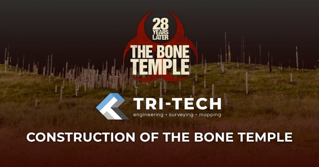
Laser Scanning, Photogrammetry and Drone Surveys for Film: Tri-Tech Surveys and 28 Years Later
Tri-Tech Surveys’ Role in 28 Years Later: From North Yorkshire Landscapes to The Bone Temple
With the release of 28 Years Later: The Bone Temple this January, audiences are once again returning to the haunting, post-apocalyptic world created by Danny Boyle. For Tri-Tech Surveys, the film’s release offers the perfect opportunity to reflect on our involvement in the original 28 Years Later production — a project that showcased how advanced surveying technologies such as laser scanning, photogrammetry, and drone surveys can play a vital role far beyond traditional industries.
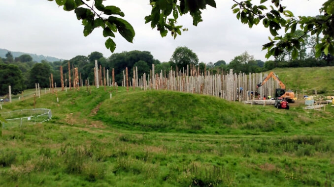
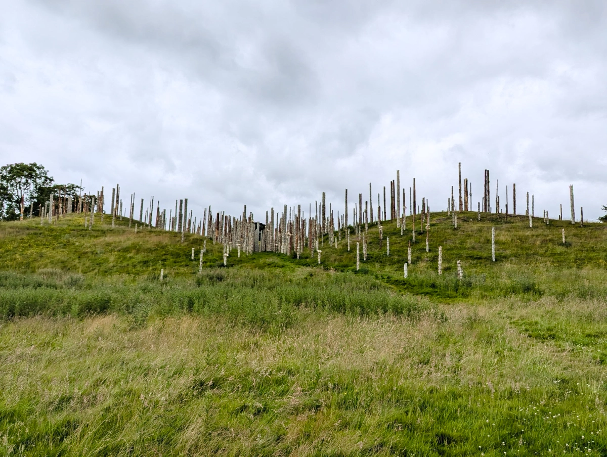
Scanning Redmire, North Yorkshire
Our collaboration with the film began in Redmire, North Yorkshire, a rural location chosen for its dramatic and atmospheric landscape. Tri-Tech was commissioned to undertake high-accuracy LiDAR and photogrammetry surveys to capture the terrain in exceptional detail. Using a combination of ground-based laser scanning and aerial data capture, we delivered precise 3D datasets that allowed the production team to generate accurate digital and physical scale models of the environment.
These models were instrumental in helping filmmakers plan camera movements, staging, and visual effects, providing a clear understanding of the site long before cameras began rolling. The same workflows are ones we regularly apply across our architectural, project management, rural, and agricultural sectors, where accurate spatial data is critical to informed decision-making.
The scale and quality of the work attracted national attention, with the production featured by the BBC, further highlighting how modern surveying technology is increasingly intersecting with creative industries.
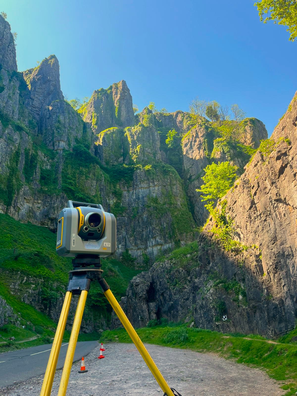
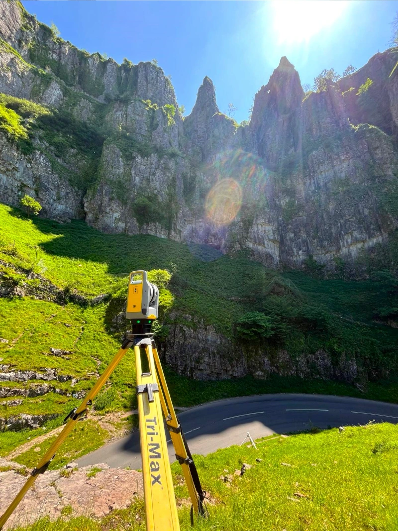
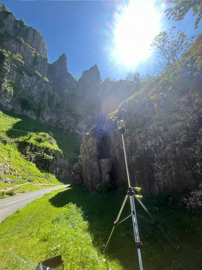
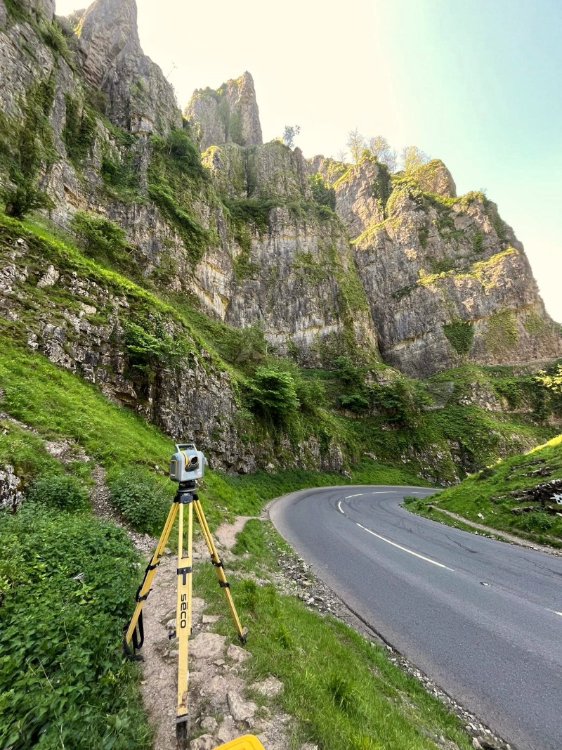
From North Yorkshire to Cheddar Gorge
Technologies Behind the Scenes
Laser Scanning
Our 3D laser scanning services provide highly accurate point clouds suitable for CAD and BIM environments. Whether supporting architectural design, heritage recording, infrastructure projects, or cinematic visualisation, laser scanning allows complex spaces and landscapes to be captured quickly and safely.
Tri-Tech’s drone surveys and photogrammetry capabilities allow us to capture large or inaccessible areas efficiently. Operated by fully qualified, CAA-compliant pilots, our UAV surveys produce detailed orthomosaic imagery and 3D surface models — the same technology that proved invaluable when capturing expansive rural locations for the film.
Rural & Agricultural Expertise
While the film project was creative in nature, much of the surveying took place in rural environments similar to those we work in daily across North Yorkshire and beyond. Our experience in rural and agricultural surveying — from topographical surveys to land management and environmental planning — ensured minimal disruption while delivering accurate, reliable data.
Architectural & Project Management Support
While the film project was creative in nature, much of the surveying took place in rural environments similar to those we work in daily across North Yorkshire and beyond. Our experience in rural and agricultural surveying — from topographical surveys to land management and environmental planning — ensured minimal disruption while delivering accurate, reliable data.
A Small Part of a Bigger Story
As 28 Years Later: The Bone Temple reaches cinemas, it’s rewarding to see how the same technologies used to support construction, agriculture, and land development also help bring fictional worlds to life on screen. The project stands as a testament to the adaptability of modern surveying and the value of accurate spatial data across unexpected industries.
And for those watching closely — you might even spot a few familiar faces. Some of our surveyors may have made brief cameo appearances, blending seamlessly into the film’s zombie-filled world… no special effects required.


