From historic landmarks to cultural institutions, our surveys provide the accuracy needed to protect, restore, and reimagine heritage assets for generations to come.
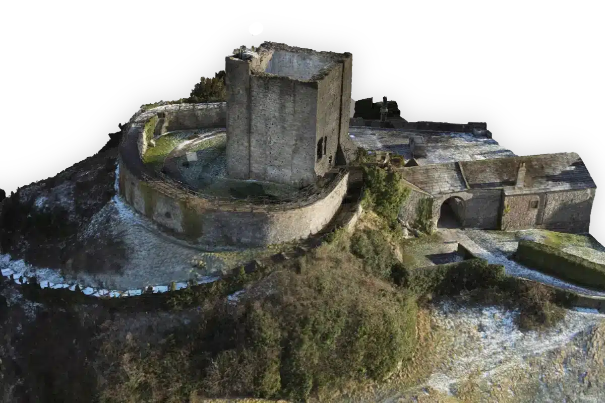
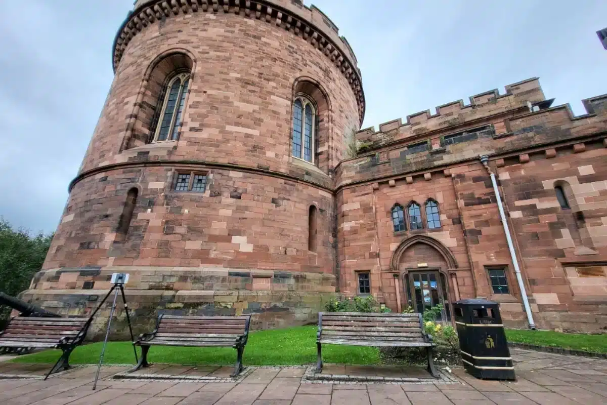
Heritage and cultural sites hold irreplaceable historical and architectural value; but with that comes complexity.
Ageing materials, fragile structures, and undocumented modifications often make redevelopment or restoration difficult.
Conventional survey methods risk damage or miss vital detail. The challenge lies in capturing every feature – from intricate façades to hidden structural elements – without disturbing the fabric of the building.
Download our heritage & CULTURAL rESTORATION gUIDE
Every millimetre counts when working with listed and historic buildings. Accurate data ensures that:
Architects and conservationists can design sympathetically
preserving original character while introducing modern safety and access.
Contractors avoid structural risks
with precise data on walls, vaults, and internal spaces.
Digital preservation becomes possible
safeguarding information long after restoration is complete.
Funding and planning approvals are strengthened
with accurate, verifiable documentation.
The Solution
Our specialist heritage surveying services combine sensitivity with state-of-the-art technology to deliver results that meet conservation standards and client ambitions.
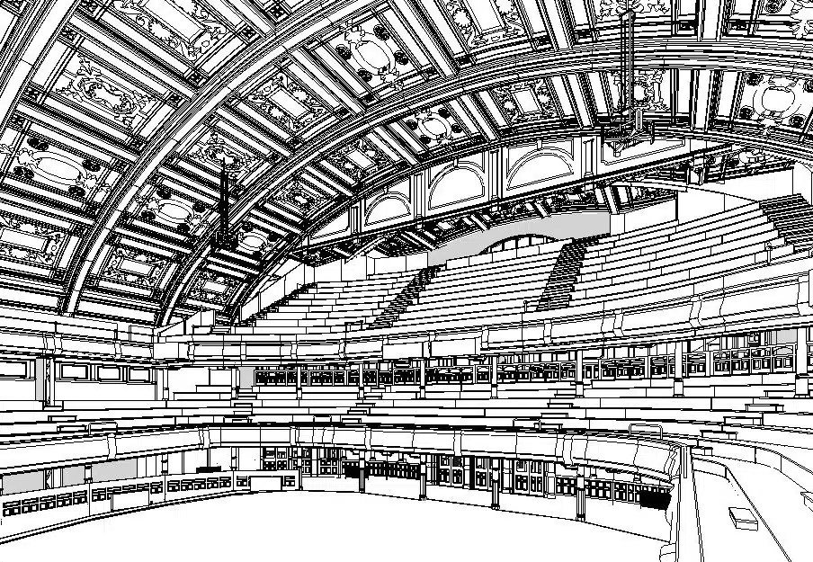
From capture to BIM, all work is completed by our skilled in-house team for full consistency and control.
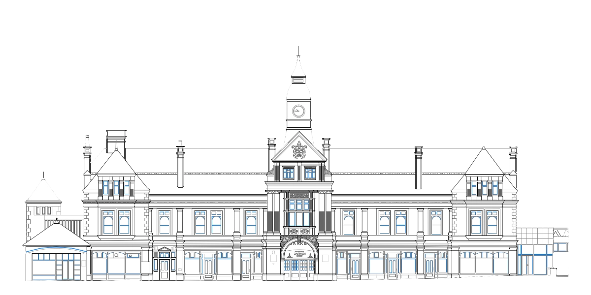
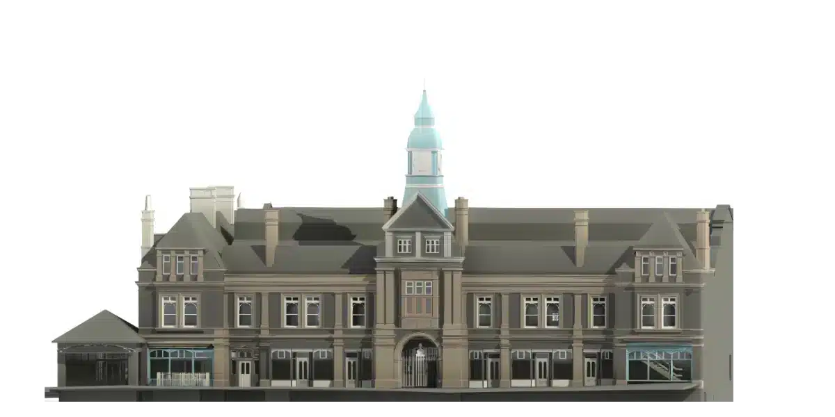
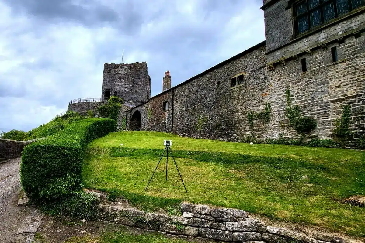
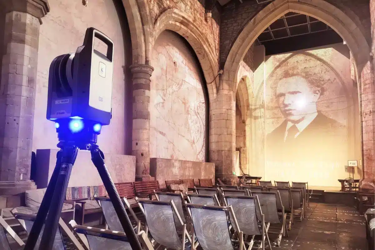
Technology in Action
We utilise cutting-edge tools like the Trimble X7 Laser Scanner and CHC RS10 SLAM Scanner to capture both expansive and confined areas efficiently.
These systems allow us to:
Work safely in restricted or delicate environments.
Capture data at multiple scales — from vaulted ceilings to carved stonework.
Produce deliverables including point clouds, Revit/BIM models and orthophotos.
Balancing Tradition and Technology
Preserving the past doesn’t mean resisting progress.
By pairing traditional surveying expertise with digital innovation, we help bring heritage buildings into the future, enabling restoration that honours history while meeting modern standards of safety, access, and sustainability.


 Leeds
Leeds Doncaster
 Sheffield
 Bradford
 Hull
Hull Halifax
 Sunderland
 Newcastle
 Middlesborough
 Yorkshire Moors
 Teesside
 Cumbria
 Harrogate
 Teesdale
 York
York Yorkshire Dales
 Northumberland
 Goole
Goole Carlisle
 Keswick
 Kendal
 Barrow-in-Furness
 Lancaster
 Blackpool
 Morecambe
 Southport
 Liverpool
 Wigan
Wigan Manchester
 Blackburn
 Burnley
 Forest of Bowland
 Oldham
 Chester
 Stockport
 Peak District
 Skipton
 Crewe
Crewe Rotherham
 Stoke
Stoke Driffield