


 Leeds
Leeds
 Doncaster
 Sheffield
 Bradford
 Hull
Hull
 Halifax
 Sunderland
 Newcastle
 Middlesborough
 Yorkshire Moors
 Teesside
 Cumbria
 Harrogate
 Teesdale
 York
York
 Yorkshire Dales
 Northumberland
 Goole
Goole
 Carlisle
 Keswick
 Kendal
 Barrow-in-Furness
 Lancaster
 Blackpool
 Morecambe
 Southport
 Liverpool
 Wigan
Wigan
 Manchester
 Blackburn
 Burnley
 Forest of Bowland
 Oldham
 Chester
 Stockport
 Peak District
 Skipton
 Crewe
Crewe
 Rotherham
 Stoke
Stoke
 Driffield

A nationwide surveying and engineering company operating in both the public and private sectors.

Read about our Surveying Services, which include Topographical Services, Utility Mapping and Monitoring Campaigns.

We have created some answers to a series of questions which explains a little more about our services.
Head Office
North West Office
Glasgow Office
Bedford Office
Bedford Office
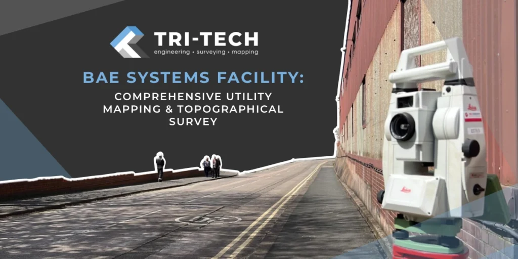
As part of a major facility expansion at the BAE Systems site in Barrow-in-Furness, Tri-Tech was commissioned to deliver a comprehensive utility mapping and topographical survey to support the design and installation of a new on-site car park and associated infrastructure upgrades.
This large-scale survey formed a critical foundation for future development, enabling the client to proceed with confidence that all existing utilities and buried assets were accurately located, mapped, and recorded before construction began.
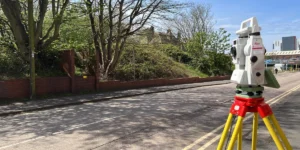
Working within an operational industrial environment required precision planning and coordination. Our multi-disciplinary survey team combined topographical surveying with detailed PAS 128-compliant utility mapping to deliver a complete picture of the site – both above and below ground.
Captured existing ground levels, surface features, boundaries, and drainage features to inform the design of the new parking and access infrastructure.
Using a combination of Ground Penetrating Radar (GPR) and Electromagnetic Location (EML) techniques, our team accurately traced underground utilities, including power, telecoms, gas, and water.
By correlating both surface and subsurface datasets, we delivered a unified model that significantly improved design efficiency and risk assessment accuracy.
Working on an active defence manufacturing site required strict adherence to security protocols, safety procedures, and operational scheduling. The key challenges included:
Maintaining full compliance with on-site safety and access restrictions
Capturing data in complex, service-dense areas with minimal disruption
Coordinating with multiple stakeholders to align survey phases with active operations
Our surveyors collaborated closely with fire service staff, adapting around emergency drills, shifts and vehicle movements to ensure safe, uninterrupted station operations.
To meet these challenges, Tri-Tech implemented:
Phased survey delivery to ensure work could proceed without interfering with daily site activities
Real-time quality assurance, ensuring each utility trace was verified before integration into final plans
Cross-discipline coordination, with our topographical and utility mapping teams working seamlessly together to deliver consistent, verified datasets
HMP Manchester is known worldwide as “Strangeways,” but behind the notoriety lies remarkable architectural value. This dual identity brought a dual challenge:
The completed utility and topographical surveys provided BAE Systems and their design partners with a highly accurate, georeferenced model of existing site conditions. This information now underpins critical design decisions for the facility expansion, helping to:
Prevent costly utility strikes during excavation and construction
Reduce design risk through verified, location-accurate data
Optimise long-term asset management by maintaining a detailed record of service locations
Support sustainable growth, reducing unnecessary rework and ensuring a cost-effective build phase
Through our meticulous approach, Tri-Tech played a key role in enabling safe, efficient, and data-driven expansion for one of the UK’s most significant industrial facilities.
This project exemplifies the value of accurate, integrated survey data in high-stakes industrial environments. By combining utility mapping and topographical surveying, we helped the client mitigate risk, reduce costs, and safeguard their assets – proving once again that precision data leads to smarter, safer decisions.