laser scanning

Land & Engineering Surveyors Yorkshire

High accuracy 3D Laser scanning services

Tri-Tech provides professional 3D laser scanning survey services for construction, engineering, architecture, and infrastructure projects across Yorkshire and the wider UK.

Laser scanning has become one of the most powerful tools in modern surveying. By capturing millions of precise measurements to create a highly detailed digital record of land, buildings, and complex environments, architects, design teams and project managers can 

Whether you require topographical laser scanning, measured building surveys, or BIM-ready point clouds, our team delivers accurate, reliable data tailored to your project requirements.

Cheddar Gorge 2

What is a Laser Scanning Survey?

Laser scanning (also called 3D laser scanning or LiDAR) uses pulsed laser technology to rapidly collect millions of highly precise spatial points. These points form a dense 3D point cloud, capturing the physical world in exceptional detail – from terrain and structures to complex infrastructure.

Unlike conventional methods that record individual measurements manually, laser scanning gathers comprehensive spatial data in a fraction of the time with excellent accuracy and efficiency.


Laser Scanning Methods:

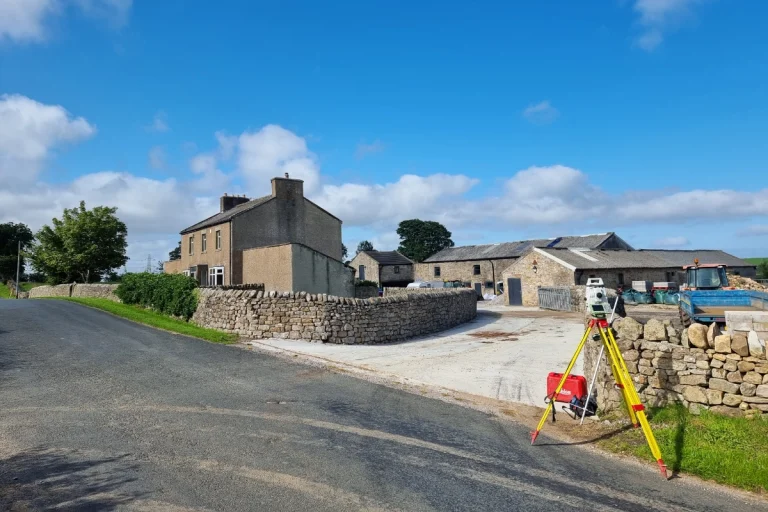
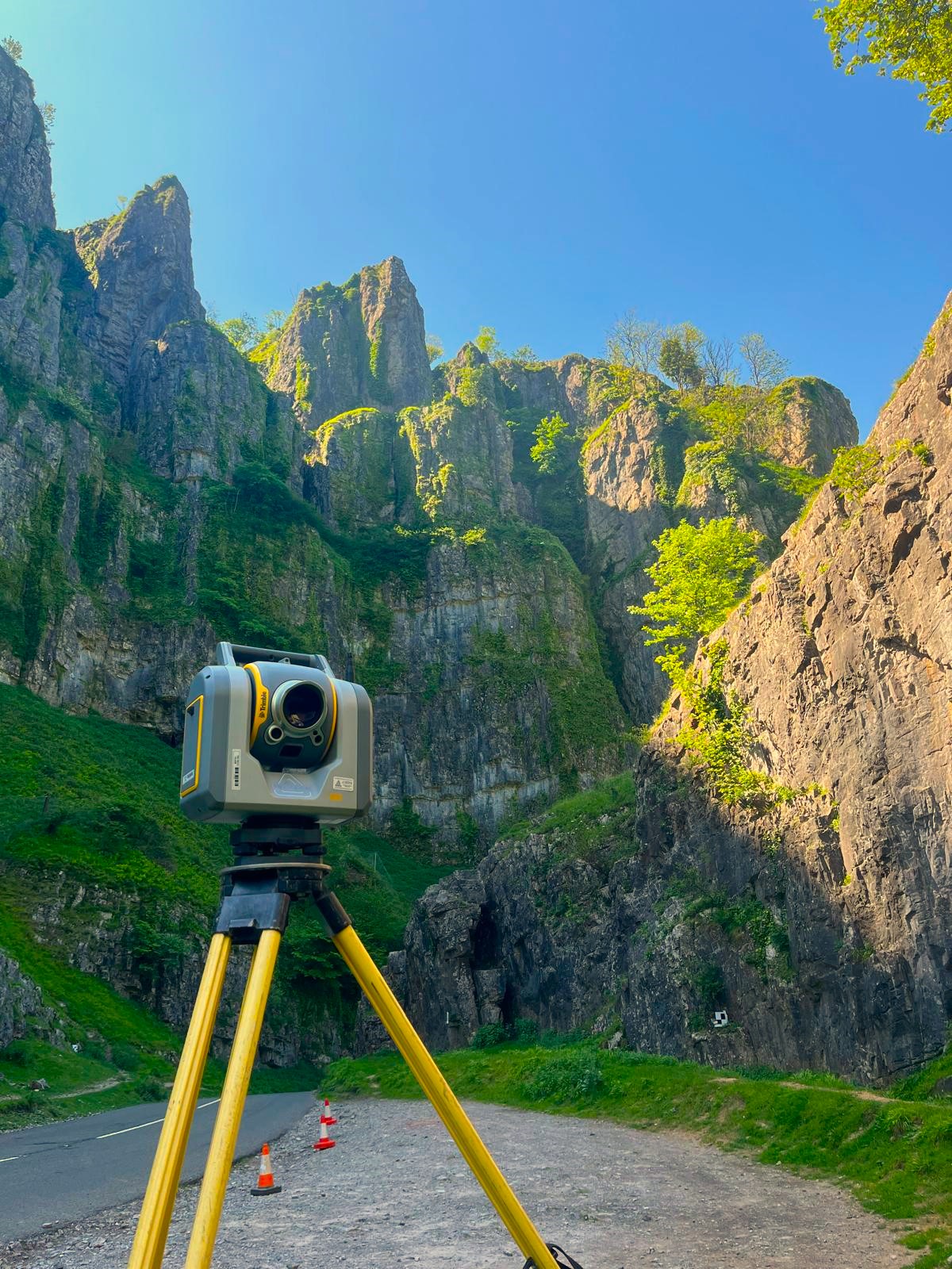
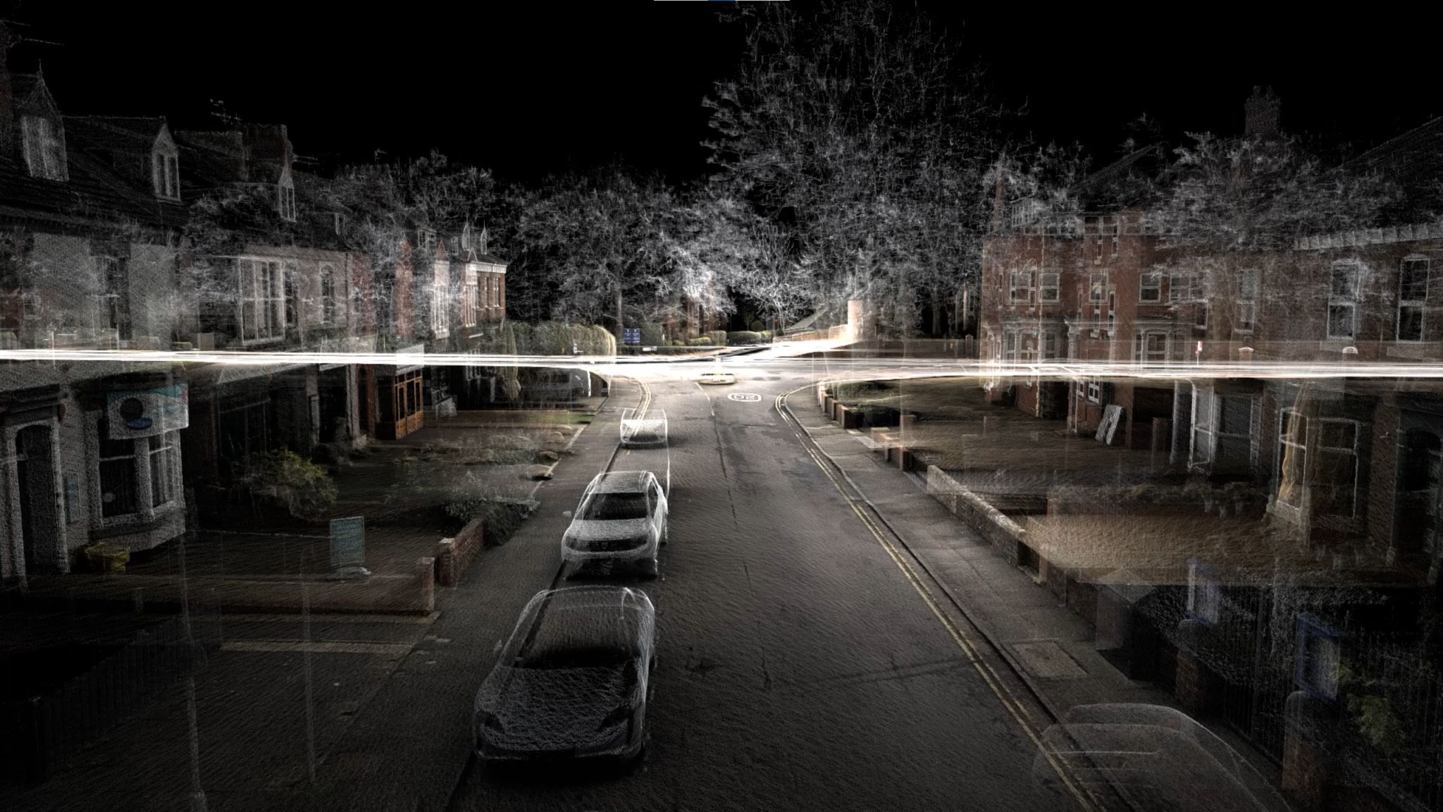
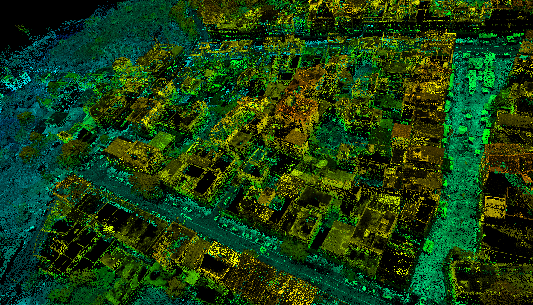
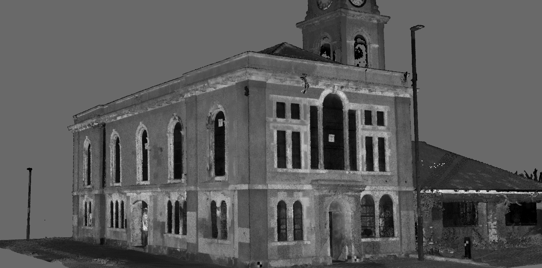
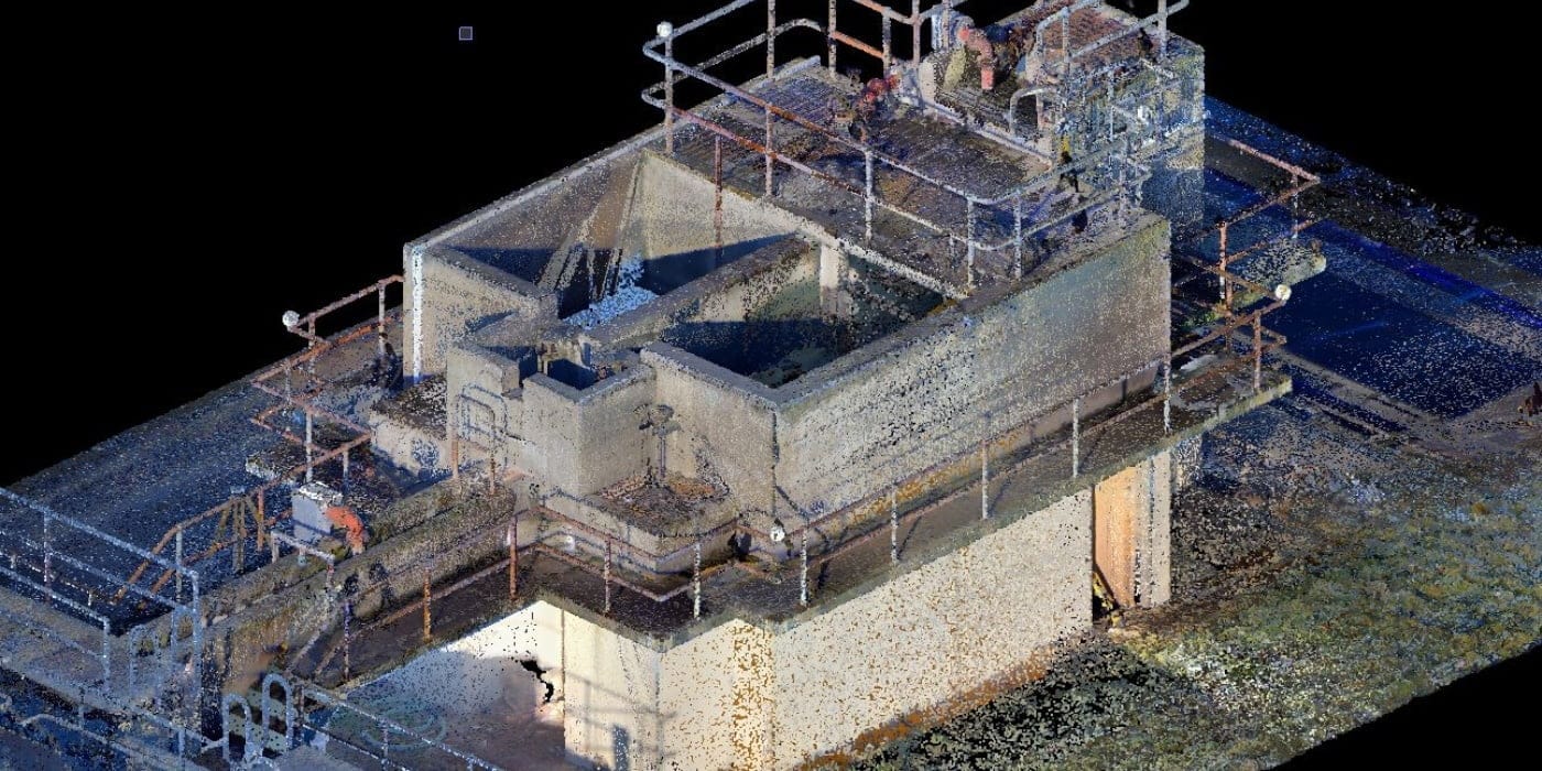
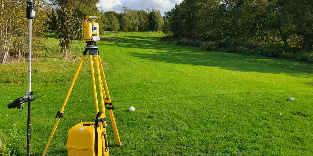
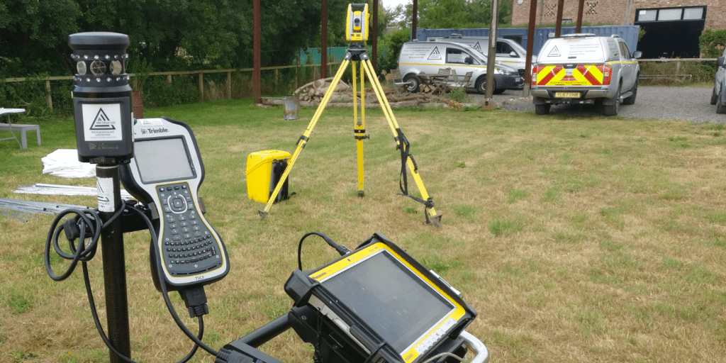
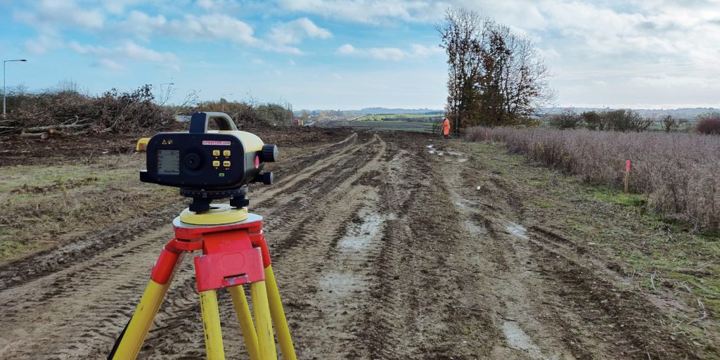
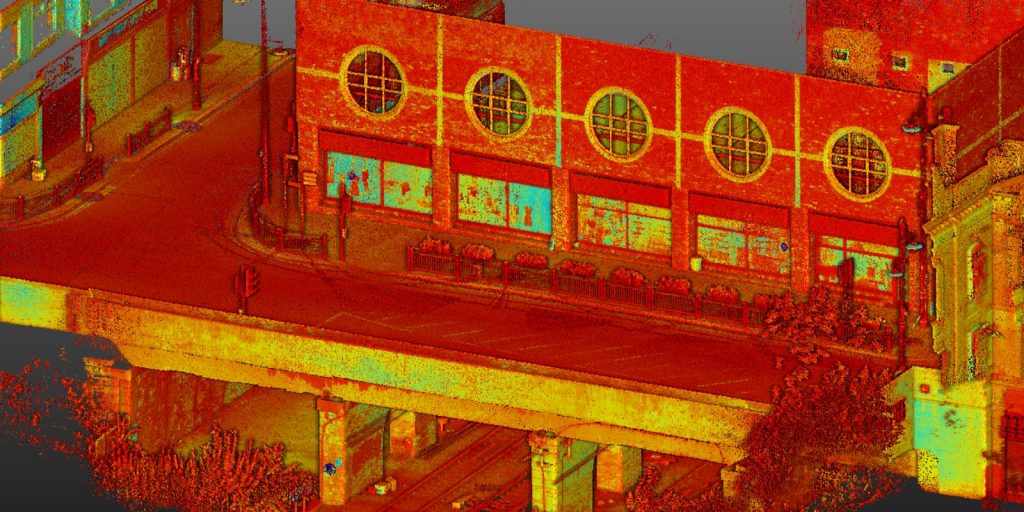
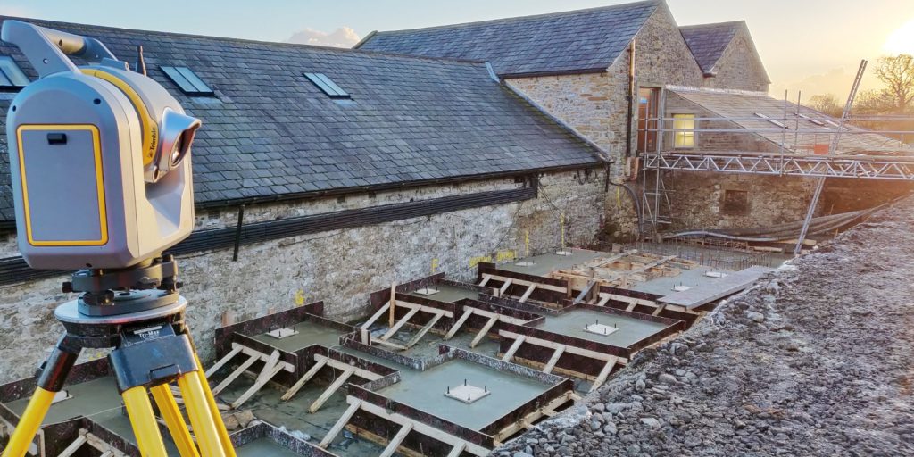
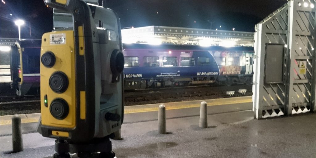
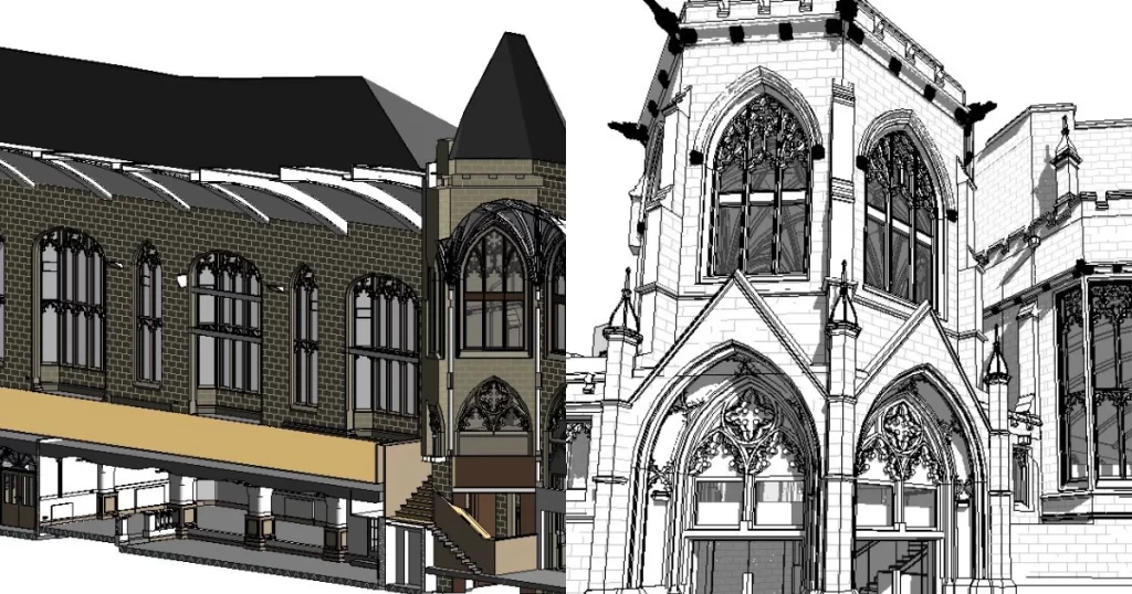
Terrestrial laser scanning captures a 360° sweep from a stationary setup, firing millions of laser pulses to build a detailed point cloud of the surrounding environment.

Ideal for:

  • Measured building surveys
  • Detailed architectural documentation
  • Structural condition mapping
  • BIM model foundations

SLAM scanners are mobile, allowing surveyors to walk through a space while capturing continuous 3D data.

Ideal for:

  • Confined or intricate interior spaces
  • Industrial facilities
  • Areas with obstructed access

LiDAR sensors mounted on drones fire thousands of laser pulses per second, measuring return time to build accurate representations of large areas from the air.

Ideal for:

  • Large or uneven terrain
  • Vegetation-penetrating surveys
  • Terrain models and corridor capture
Housing residential Laser Scanning

Why Do You Need a Laser Scanning Survey?

Laser scanning delivers a fast, safe, and highly accurate method of capturing existing site conditions. It is ideal for:

  • Complex construction environments
  • Large-scale topographical mapping
  • Refurbishment and retrofit projects
  • Infrastructure and asset management
  • Design coordination and BIM workflows

Why Laser Scanning Matters

Laser scanning revolutionises survey data collection by offering:

SPEED

Capture complex environments far faster than traditional methods.

Accuracy

Millimetre-level precision for detailed modelling and analysis.

Safety

Data captured from a distance reduces need for access to hazardous areas.

Coverage

Hard-to-measure features are recorded in dense 3D point clouds.

What Will You Receive from a Laser Scanning Survey?

When you commission a laser scanning survey with Tri-Tech, you receive accurate, design-ready digital data that can be used immediately for planning, modelling and construction.

Depending on your project requirements, typical deliverables include:

Point Cloud (LAS, E57, RCP)

2D CAD Drawings (DWG/ DXF)

PDF plans and elevations

3D mesh models and surfaces

BIM & Revit-ready deliverables

Contour, volume and terrain analysis

LASER SCANNING FOR YOUR SECTOR
Surveying Services for Multiple Industries

Environmental & Energy

Environmental & Energy

Public Sector

Public Sector

Defence & Justice

Defence & Justice

Rural & Agriculture

Rural & Agriculture

Architecture & Project Management

Architecture & Project Management

Commercial

Commercial

Heritage

Heritage

Bathymetric & Hydrographic

Bathymetric & Hydrographic

Industrial

Industrial

Housing

Housing

Demolition and Remediation

Demolition and Remediation

General Construction

General Construction

Infrastructure, Roads and Highways

Infrastructure, Roads and Highways
Why Choose Tri-Tech for laser scanning?

expertise

in choosing the right scanning method for every project

High-accuracy

3D data capture and processing

national

coverage with based in Yorkshire

Professional

clear and client-ready deliverables

support

from to early phases and beyond

What we do
our services

Land and Engineering Surveyors

Tri Tech Topographical 5

topographical surveys

Tri-Tech work for a variety of different clients on different projects, and we pride ourselves on delivering accurate, efficient, cost effective surveys ensuring our clients receive the best possible product.

Utility Mapping 5

utility mapping

Using the latest equipment, we can provide the location of underground services in either 2D or 3D. We use state of the art Ground Penetrating Radar and Electromagnetic Location to assist your project when service avoidance may be a potential issue on site.

Monitoring 3

monitoring

Is there any movement? That is the question that is asked before and during any monitoring scheme.  That is the reason we undertake monitoring, to check for movement.

3D Laser Scanning Tri-Tech Surveys

laser scanning

For mass collection of accurate survey data then nothing beats scanning.  Using 3D laser Scanners the surveyors can capture millions of points per second with the creation of a PointCloud. 

Volumetric Analysis Tri-Tech Surveys

volumetric analysis

We specialise in the analysis of a scheme’s volumetrics at any point in time.  Be it Tender, Prestart, Monthly, Weekly, or Final.

River Surveys Gallery 4

Bathymetric surveys

By using the latest surveying technology, we have been able to survey watercourses safely and efficiently.

Setting Out and Site Engineering

setting out & site engineering

Bread and butter work for us!  Having a strong relationship with many civil engineering companies we have a very strong team of Site Engineers and Engineering Surveyors working for us. 

3D Machine Control Tri-Tech Surveys

control network installation

At Tri-Tech we have vast experience in this field.  Be it a large highway scheme or a private property we can advise on what accuracies are required from your control network depending on what work you are carrying out and the tolerances you are carrying this work out to.

UAV 3

uav mapping & aerial surveys

Large areas of ground can be covered capturing the most unbelievable detail which would just be unable to be recorded with traditional methods.  Our clients have really seen the benefit of what UAV surveys bring to the table.

Measured Building Surveys 2

measured building surveys

Tri-Tech work for a variety of different clients on different projects, and we pride ourselves on delivering accurate, efficient, cost effective surveys ensuring our clients receive the best possible product.

3d 2

3d machine control

Machine control systems have been around for years now and Tri-tech have been utilising these systems from the very start.  We realised the benefits of these systems early on when working with earthworks contractors.

Equipment Hire 3

survey equipment hire

Being a leader in the Surveying and Engineering sector we have a fleet of modern survey equipment at our disposal which is second to none.  We carry the latest GNSS Base Stations, GNSS Rovers, Robotic Total Stations, Laser Scanners, Digital Levels, and Dual Grade Lasers.

BIM Model Feature

BIM Model Creation

BIM (Building Information Modelling) model creation in surveying refers to the process of using specialised software to create a 3D digital model of a building or infrastructure project that includes information about the project’s design, construction, and maintenance.

Virtual Tour 3D News TriTech

Virtual Tour 3D

Virtual Tour 3D is an immersive experience which instantly transports your clients to your business, and guides them through your space, creating a seamless and captivating experience.