Leeds
Leeds Doncaster
 Sheffield
 Bradford
 Hull
Hull Halifax
 Sunderland
 Newcastle
 Middlesborough
 Yorkshire Moors
 Teesside
 Cumbria
 Harrogate
 Teesdale
 York
York Yorkshire Dales
 Northumberland
 Goole
Goole Carlisle
 Keswick
 Kendal
 Barrow-in-Furness
 Lancaster
 Blackpool
 Morecambe
 Southport
 Liverpool
 Wigan
Wigan Manchester
 Blackburn
 Burnley
 Forest of Bowland
 Oldham
 Chester
 Stockport
 Peak District
 Skipton
 Crewe
Crewe Rotherham
 Stoke
Stoke Driffield


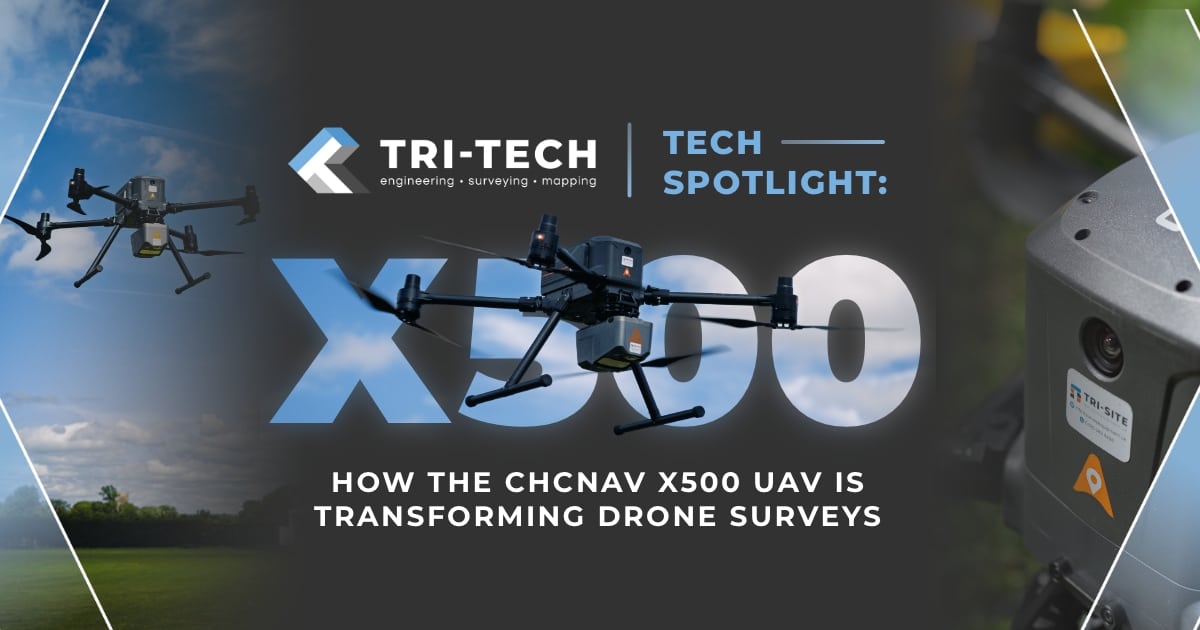
In today’s evolving world of geospatial data and site intelligence, the demand for accuracy, speed, and safety has never been greater, especially when working in high-risk or hard-to-reach areas like quarries, construction zones, or heavily vegetated terrain.
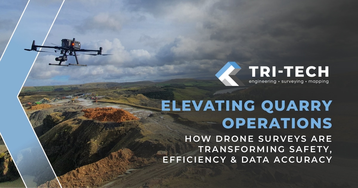
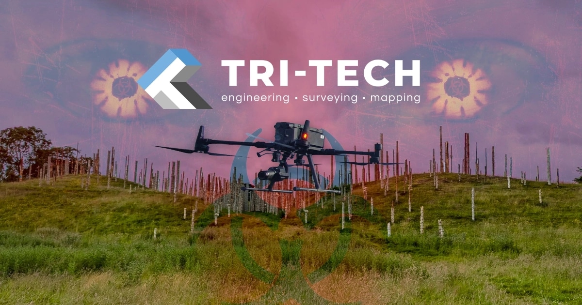
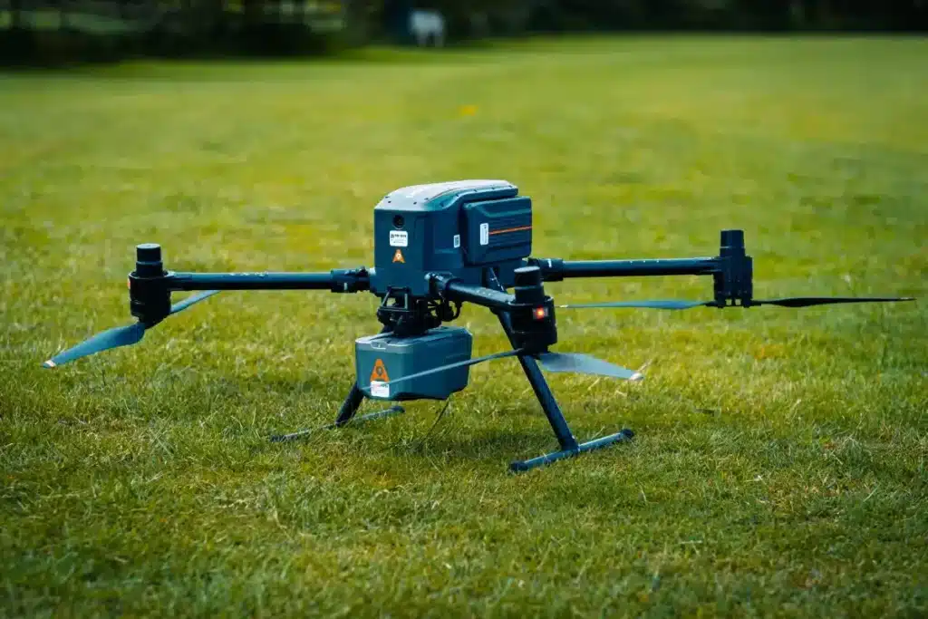
We’re proud to be at the forefront of aerial surveying technology and one of the key tools in our lineup is the CHCNAV X500 UAV: a high-performance rotor drone designed for the kind of precision and endurance that modern surveying demands.

Advanced Engineering for Demanding Missions
The CHCNAV X500 surpasses a typical drone; it is a professional-grade platform built specifically for heavy-duty data capture. With a five-kilogram payload capacity and nearly an hour of flight time, it’s engineered to cover large areas efficiently without sacrificing accuracy.
What truly sets it apart, though, is its reliability in complex environments. Redundant flight systems, including dual GNSS, triple IMUs, and intelligent return-to-home features ensure the X500 remains stable and on course even in challenging conditions. Whether it’s flying near structures, operating in changing weather, or working across varied terrain, this drone brings unmatched stability and control.
Built for Safety in the Field
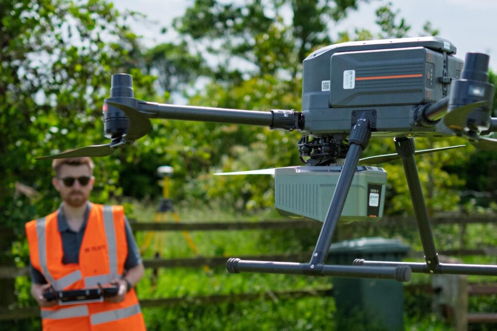
On active sites like quarries or infrastructure projects, safety is everything. That’s why the X500 is equipped with advanced onboard safety systems, including obstacle detection radar and visual SLAM (simultaneous localisation and mapping). These features allow the drone to detect and avoid objects in real time, even when GPS signals are limited.
Its IP55 protection rating and ability to resist winds up to 12 m/s mean it performs reliably in the kind of unpredictable UK weather that would ground lesser systems. From narrow corridors to tree-lined landscapes, it delivers precision without putting boots on unstable or hazardous ground.

Intelligent Data Capture Beneath the Canopy
When paired with the CHCNAV AA10 LiDAR, the X500 excels at capturing what’s hidden beneath the surface. The AA10’s multi-echo capability, detecting up to eight returns per laser pulse – makes it possible to penetrate dense vegetation and accurately model the ground beneath.
This is especially powerful in areas where traditional survey methods fall short, such as forested zones, overgrown brownfield sites, or drainage channels surrounded by thick undergrowth. Even in those difficult environments, we’re able to produce accurate digital terrain models, elevation data, and stockpile volumetrics.
When you choose Tri-Tech for UAV work, you can rest assured that we carry out your surveying needs using high-quality technology, with trained and experienced professionals who understand your requirements. And we do so with accuracy, integrity and expertise, delivering you insights from every angle.
From land to sky, you can trust Tri-Tech to get the full picture.
A Flexible Platform for Multi-Purpose Missions
One of the biggest advantages of the X500 is its adaptability. It supports up to three payloads at once and is compatible with a wide range of CHCNAV and third-party sensors, including RGB, thermal, and LiDAR. Built on the universal Mavlink protocol with an open SDK, it allows us to configure and customise each flight to the needs of the site.
Whether we’re conducting a volumetric survey, mapping a haul road, or performing an inspection over a live site, the X500 provides the flexibility to capture exactly what’s needed, all in a single deployment.
This flexibility allows us to deploy the X500 for a wide range of missions, including:
• Topographic and engineering surveys
• Urban mapping and infrastructure inspection
• Thermal imaging and asset monitoring
• Search and rescue coordination
• Disaster relief and emergency scouting
With the ability to customise payloads for each project, we can deliver detailed, accurate, and highly relevant outputs, tailored to the client’s goals.


Supporting Smarter, Safer Decisions Across Sectors
Across civil engineering, environmental consultancy, public safety, and construction planning, the CHCNAV X500 is helping clients access clearer, more actionable data, without the time, cost, and risk of traditional ground-based methods.
By removing access constraints, improving site visibility, and accelerating data delivery, drones like the X500 are supporting better decisions, faster project cycles, and more efficient workflows.
Let’s Take Your Surveying to the Next Level
As drone technology continues to advance, tools like the CHCNAV X500 are paving the way for smarter, safer, and more efficient surveying practices. At Tri-Tech, we’re proud to deliver forward-thinking aerial survey solutions using industry-leading tools like the CHCNAV X500. Whether your project involves infrastructure, ecology, asset inspection, or emergency response, our expert team is ready to help you access the data you need safely and efficiently.
Interested in learning more?
Download our drone survey brochure and find out how the CHCNAV X500 can support your next project.