Leeds
Leeds Doncaster
 Sheffield
 Bradford
 Hull
Hull Halifax
 Sunderland
 Newcastle
 Middlesborough
 Yorkshire Moors
 Teesside
 Cumbria
 Harrogate
 Teesdale
 York
York Yorkshire Dales
 Northumberland
 Goole
Goole Carlisle
 Keswick
 Kendal
 Barrow-in-Furness
 Lancaster
 Blackpool
 Morecambe
 Southport
 Liverpool
 Wigan
Wigan Manchester
 Blackburn
 Burnley
 Forest of Bowland
 Oldham
 Chester
 Stockport
 Peak District
 Skipton
 Crewe
Crewe Rotherham
 Stoke
Stoke Driffield


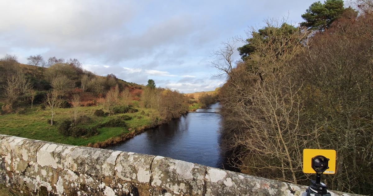
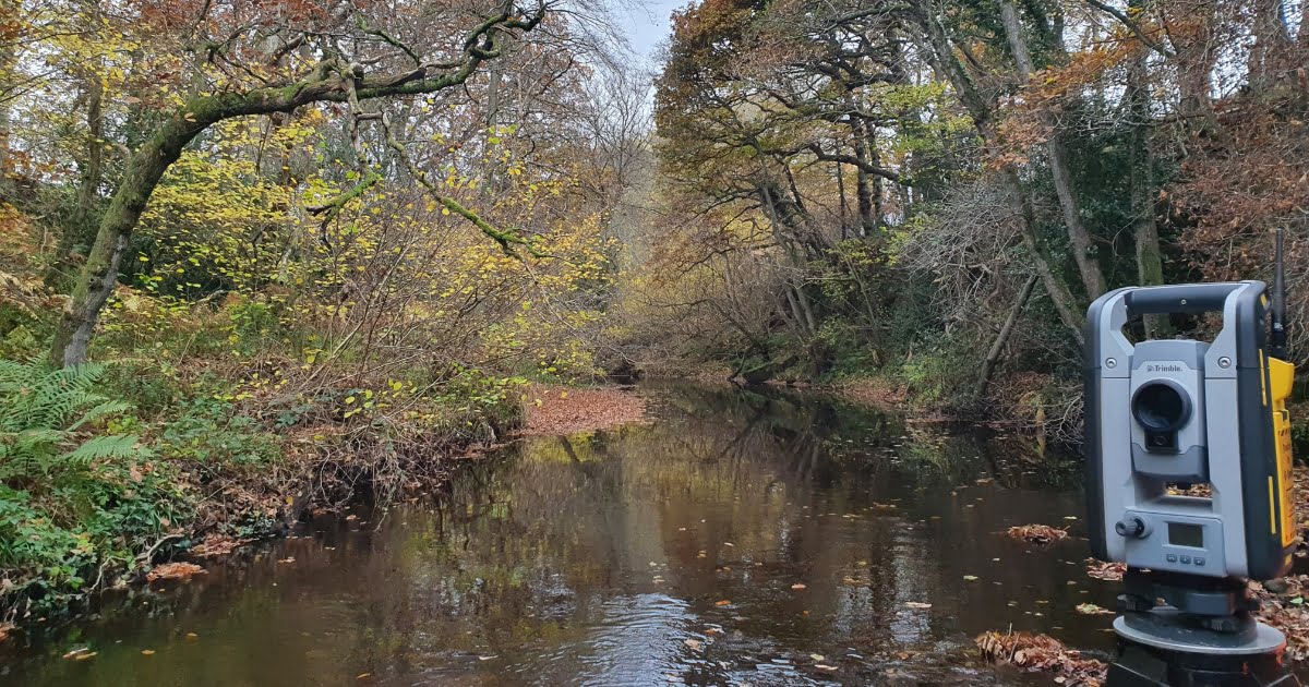
A river survey is a type of hydrographic survey that involves measuring and mapping the physical features of a river and its surroundings, including its channel, banks, and adjacent land. River surveys are typically carried out by hydrographic surveyors using specialised equipment, such as boat-mounted echo sounders, global navigation satellite systems (GNSS), and total stations.
The purpose of river surveys is to gather information about the physical characteristics of a river, such as its width, depth, flow rate, and bed profile, as well as its surrounding land, including vegetation, structures, and topographical features. This information is used for a variety of purposes, including:
- Flood risk management: River surveys can provide critical data about a river’s hydrological characteristics, which can be used to predict and manage the risk of flooding.
- Water resource management: River surveys can be used to gather data about water flow rates, which can be used to manage and allocate water resources, such as for irrigation and drinking water supply.
- Navigation and dredging: River surveys can be used to determine the depth and width of a river channel, which can be used to plan and improve navigation and dredging activities.
- Environmental management: River surveys can be used to gather data about the physical characteristics of a river and its surrounding land, which can be used to support environmental management and conservation efforts.
- Hydroelectric power generation: River surveys can be used to gather data about the flow rate and topography of a river, which can be used to design and optimize hydroelectric power generation systems.
River surveys typically include the following elements:
- Hydrographic surveys: Surveys of the depth and bed profile of a river, which can be used to produce bathymetric charts and cross-sectional views of the river channel.
- Topographical surveys: Surveys of the surrounding land, including vegetation, structures, and topographical features, which can be used to produce topographical maps and models of the river and its surroundings.
We can also provide:
- Bathymetric surveys: Survey created using the Sonarmite boat. An example is displayed in this quary survey post. The boat has a Sonar signal generator and detector onboard which transmits a signal through the water and detects the return to determine the depth of the water body and when combined with a total station or GNSS receiver, we can create a 3D coordinate at bed level and create a 3D model.

River surveys provide critical data about the physical characteristics of a river, and are an essential tool for anyone involved in the management, planning, and development of rivers and the surrounding lands.